Tuesday, July 15, 2008

July 2008

Monday, July 21, 2008

Two hours of fast movin’

I got out today for about two hours on the bike at Bent Creek. I started at the new parking lot and headed up to Boyd Branch Rd->Sidehill?->Ingles Field Gap->N. Boundary-> to Green Slick->Sidehill->Little Hickory Top->Ingles->??->all the way down down down to Hardtimes connector->Hartimes->pavement->back to the new lot.

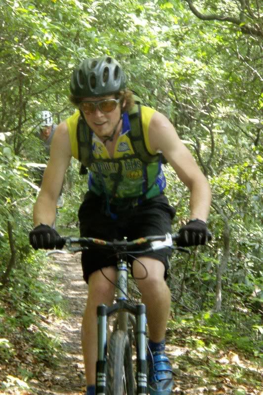
quick breather on Sidehill:

I started with a quick mechanical issue since I just reinstalled the Brooks Swift saddle, it wasn’t in the right position. I then had a great climb and only dropped into the little ring for the steeeeeeep part of Ingles Field. I was amazed at how quickly I got to Green’s Lick so I must have been feeling good. It was a hot, busy day at Bent Creek. There were riders and hikers around just about every corner. Oh, on the way up Ingles I was almost runover by a dude on a rigid 29er. I saw him, called out ‘rider-uuuuup….’ and he went into an awesome emergency skid/tailslide and buzzed by me with a smile and a nearly incomprehensable ‘thnxmn’. That made me smile.

It was a hot day and the plants were suffering along with the rest of us. I found this flower soon after the Sidehill break. Too bad the focus is off… Anyone out there know of a DURABLE point-and-shoot with EXCELLENT macro capabilities?

Anyway, at Green Slick there was a whole crew lining up so I didn’t rest, I took 2nd place behind their leader. They were having trouble with the topmost filter thing so I decided it was a good idea to get ahead. I passed the 1st guy as soon as he realized I wasn;t in his group but he held on and he had a great run of the top. When I flew into the triple filter I lost him though. I stopped at the little up and he came flying up with a smile and told me I was rockin’ it…. sweeeet. He had never seen a Waltworks before so I showed him some of the finer points before heading down the next 2/3 of the downhill BMX track that we have now…..

more later…

Posted by Eric Wever / Pisgah Productions at 01:27:56 | Permalink | Comments (1) »

Sunday, July 20, 2008

New road ride loop

Erinna and I got out this evening for a fun little road ride. From W.Asheville->Beverly->Riverview->Riverside->turn at the water plant->up to Merrimon->Griffing->Patton Mtn Road (gravel road in the city)->Town Mtn Rd.->MLK->Charlotte St->Asheland->McDowell->Amboy->State->Hanover. Under two hours at an easy pace.

21 miles, 2400′ of climbing, 1:45 out.

Posted by Eric Wever / Pisgah Productions at 01:37:18 | Permalink | No Comments »

Sunday, July 13, 2008

It’s Tricky to rock a rhyme, to rock a rhyme that’s right on time…..

Thanks Jody, I had that song stuck in my head all day because of you….

Jody F. and I got out today and did Heartbreaker via Curtis Creek today. We carpooled from the Swannanoa exit to the geyser and got started at a few minutes after 10AM. We were rockin’ today! We did the whole ride in just over 6 hours! Actually, over 6 is FAR too long for this ride… I bonked pretty hard once we hit the parkway.

The ride started after two others didn’t show up with the climb up to Star Gap. We were giving the switchbacks up our all and the intersection came pretty quickly. Jody had never done the Star Gap/Grassy Road of Death/ Curtis Creek loop so I was happy to let him lead out on that killer descent to the grassy road. New trail in Pisgah is becoming a rare thing; I figured he’d have a blast. He did, we rocked it out. The turn onto grassy road was followed by the rollers then the big climbing rollers, and then the big climbing started…… then the big descent to Curtis Creek. I must have pushed a little too hard on those few (4-6?) miles because when I hit the bottom I had vivid memories of Teamdicky and The Wonderboy riding away from me from that same spot.

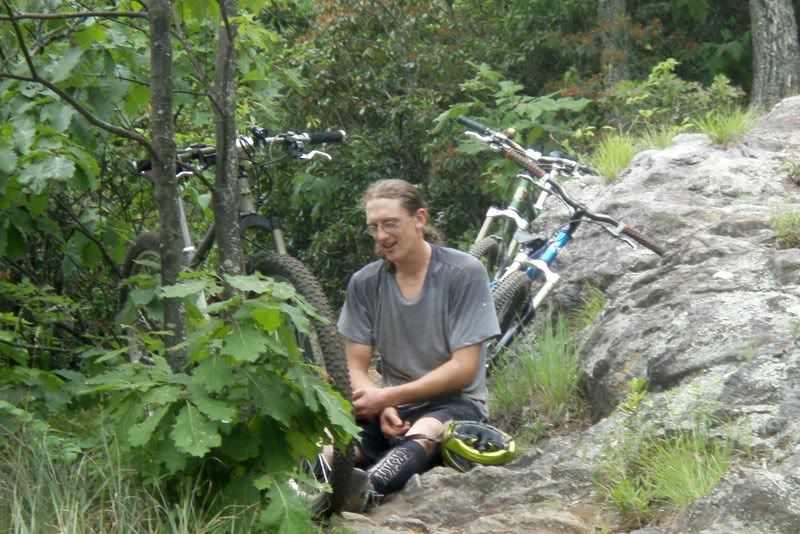
Jody fiddlin’ with his brakes on Grassy Road:

Jody was on a SS and feeling good so he was out front immediately. Aaawwww hell…. Here we go….Curtis Creek turns from pavement to gravel then the pitch heads upward in a severe fashion. I was in granny gear nearly right away and visions of walking the upcoming 5 miles on the parkway were dancing through my head. The road has finally been completely repaired from the Hurricanes of 2004 and that made the going easier than before. Not that they are say… easy…. just… easier than before. The new bridges are taller also, so getting up onto them requires negotiating a longer, steeper pitch now. Jody was waiting at the bridges and I showed him the incredible damage that was done by the seemingly innocent trickle of a creek that was under this new massive bridge. Anyway, as I had warned Jody, the road then gets even steeper once again and it was everything I had to keep my heart rate down, my temp under control (It MUST have been approaching 90*), to drink, eat, soft pedal…. Then we hit the gravel road switchbacks and I took my jersey off. Of course, right away a thunderstorm decided to pop-up and the jersey was back on as soon as the cold rain hit my bare skin. Notice I’m going on and on about this climb. Well, there’s a reason why…. It goes on forever and ever. When you finally see the parkway…… It’s like, still 3 more miles of horrific climbing to get there. uuuugh.

When we got to the parkway I was cooked. Two miles of mind numbing, calf cramping, hell climbing then two miles of blissful road descending then another mile of climbing passed then we turned at Heartbreak Ridge. We stopped there before the hike-a-bike and took a niiiiiice looooooong breather. The rest did me good, the hike was over quick and the descent down heartbreak was all that separated us from the vehicle. Oh yeah, it rained on us from the top of Curtis Creek almost all the way to Heartbreaker.

Heartbreak Ridge was slick and slimy. Jody took lead and I had a great time following him. Having just two people out there was a blast. Don’t get me wrong, big groups are fun too… but when two are it, there’s no checking up. We were cautious but moving fast. Trying tech moves but not riding over our heads.

Well, almost… here’s Jody after letting his front wheel slip off the side of the trail:

The second climb was over before I knew it and as we were stopped by a hiker (who was looking for an ‘at risk youth’ who ran off down Star Gap hours before…. dumbass) I was surprised we were there already. switchbackswitchbackswitchback….. and we were at the campthen gravel, cross the tracks, gravel, pavement and back at the car/miniminivan thing just over 6 hours after we started. Thank the lord because I was D-O-N-E.

Thanks for waiting for me and having such a great attitude Jody. I hope your wife isn’t too mad that I kept you out for so long! Oh and great riding as always.

Oh, check back later for videos. Right now I going to eat a big meal, drink a beer, say Hi to my sweetie, get ready for work tomorrow, watch Le Tour on Le Tee Vee, and….. well…. actually check back tomorrow for videos….

Posted by Eric Wever / Pisgah Productions at 23:38:21 | Permalink | Comments (1) »

Sunday, July 6, 2008

THUNDERSTORM!!!!

Erinna and I just got in from a little over two hours out on the bikes. We started at 2:15 at the Campground Connector in Bent Creek. Rain had passed through earlier in the day and had given way to temps in the 80’s, sunshine, and the threat that the rain wasn’t quite over. We climbed Bent Creek road all the way to the parkway to start. Erinna kept the pace high and we got to the parkway SOAKED with sweat. It was muggy and warm and that climb is a tough way to warm-up. We hit the parkway and rode through the three tunnels and past the two overlooks and turned at the top of Trace Ridge. Remember kiddies, always walk you bike within parkway boundaries….mmmmkay? When we reached the Spencer intersection the threat of rain was replaced with huge thunder boomers off in the not so distance. We contemplated heading down Spencer but forged onward to the top of the little hell climb where Trace really starts to descend. Erinna noticed something was wrong with the front end of her bike but couldn’t figure out what…. so I rode to the top. I also figured out what was wrong…. she had a slow leak in the front tire. As I changed the tube out the storm caught up to us. The thunder boomed and Erinna asked ‘are you scared?’ I said ‘No, not really, I want to get off this peak though’ She replied ‘well, I am…..’ I finished as quickly as possible then we retraced our steps and headed down Spencer towards FS5000. What was suddenly upon us was more than a thunderstorm. It was a sign of the apocalypse. It was pea/marble size hail, lightning/thunder with simultaneous flash/concussions, raindrops the size of golf balls, and suddenly Spencer Gap trail became Spencer Gap creek. The water was flowing so fast that our actual speed was hard to judge. The trail looked like it was made of chocolate milk and moving faster than we were.

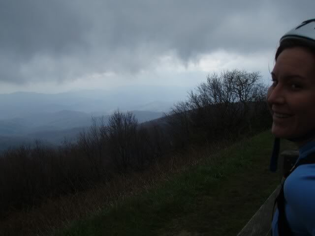
Here’s a shot of Erinna at the field on Spencer Gap:

I was laughing out loud repeating adjectives: Amazing. Unreal. Unbelievable. REDICULOUS! The trail was a flowing body of water, 6 inches deep. I was also thinking to myself: I’m freezing cold. This storm has GOT to pass. Thank God the wind is low… I don’t need to dodge a falling tree right now.

The storm did pass just as we hit 5000. Erinna once again held the pace high and in what felt like no time at all we were back at the BRP. As it goes when the forecast is ‘30% scattered thunderstorms’ here the sun was out and as we started our descent back into Bent Creek we were actually watching steam rise from the roadbed. We took the left onto Lower Sidehill trail and after a little climb were descending on singletrack. It looked like that side of the ridge had hardly gotten rain at all.

Erinna haulin’ ass at the bottom of Lower Sidehill. Big wheels rollin’!

We beat the rain back to the Jeep, got loaded up and got out of there so Erinna could get back to her studies. We did meet an interesting crew at the end. One girl had crashed hard on Green’s Lick but she was unharmed and in her morale was high. Her beau limped her bike out for her though… it didn’t fare as well… the front wheel was… not so round….

Memorable ride for sure. 2.5 hours out. Thanks for taking a study break Sweetie!!!

Posted by Eric Wever / Pisgah Productions at 21:59:39 | Permalink | Comments (2)

Friday, July 4, 2008

Laurel Mountain -> Pilot Rock

Today was great. I got out and did Laurel/Pilot from Yellow Gap with a fun crew:

Ian ‘the pony’ L.:

Callum R.:

and Cody S.:

I had never ridden with Callum or Cody before. Actually, Cody and I hadn’t even met until Ian pulled up in his big-ass-truck around noon-thirty today. We drove up to Yellow Gap and were on the trail pretty quick. Everyone but me hit the trail like bats out of hell but after about ten minutes Ian and I were riding together. I passed and kept the pace solid but not over the top (read: I didn’t chase Callum and Cody) and Ian held my wheel… dispite his huffing and puffing. Even though the tempo started high everyone, including me, was out just to be out in the woods and have fun. Long breaks and laughs were abundant. … So were high cadences, big efforts, and the usual git-it-git-it-git’s…. and yeeeeeaaaaaaahhhhhhhhhh!!!!!!’s….. and WHOOOOO GOOD JOB MAN!!!’s. Just like a couple of days ago Laurel’s landmarks passed by quickly. This time around I made more of an effort to clean the lower super-tech and am happy to report a little practice makes for excellent results. I cleaned just about every ridable obstacle *cough*exceptthesupereasyfirstcreek*cough*. I left the chain in the middle ring more than I probably should have, too…. but I was feeling good. Callum and Cody were climbing like madmen all day. Cody wasn’t even clipped in. After a quick breather at the gap we took the Pilot connector and for the first time in forever I cleaned it! Callum was right there with me and moments after we hit Pilot Cody and Ian arrived. The descent down Pilot started with me following Callum and Cody but I passed Cody at the first safe place. Callum was lipping off of any little thing he could and we both took the switchbacks like we were on rails. We regrouped at both overlooks and at the no-name trail to the inner-loop. Cody took a hard spill and jacked his wrist, Ian’s quads were locking-up, and a HUGE thunderstorm was overhead so the decision was made at the intersection to head down rather than up-over-and-around the Slate/Pilot loop. The trail was slick and soupy in moments but we were at the road and headed back to the big-ass-truck before it got too bad. Callum and Cody rocketed away on the final climb and Ian and I chilled, knowing that no-matter-what…. we were only going to be only five minutes behind…. and he had the keys.

A few videos from the Pilot Rock descent, following Callum:

hmmmm… photobucket wasn’t cooperating earlier so here’s the same vid on youtube. It was dark out because of the impending thunderstorm so the original vid isn’t the best…. but boy o boy does youtube’s compression suck!

alt : http://www.youtube.com/v/08h8qURuzW8

Posted by Eric Wever / Pisgah Productions at 23:49:25 | Permalink | Pilot Rock">No Comments »

Thursday, July 3, 2008

The Classic Big Creek Loop

I made it out today for an excellent ride: From N. Mills River Campground->FS1206->Laurel Mountain->Gnome trail->Blue Ridge Parkway->Big Creek->Reservoir Road->Lower Trace->Fisherman’s Trail back to the Jeep. 19.5 miles, 3500′ of climbing, 3:55 out.

The view from the parkway:

I started at 1:20 and was pleased that the initial climb to Yellow Gap took only 35 minutes. I’m feeling out of shape but none-the-less 35 minutes is only 5 off my target for that climb. I took a quick breather at the gap but continued the climb up Laurel after just a moment. Climbing Laurel is like having a conversation with an old friend. You know where it’s going and about how much energy you’ll expend but they always surprise you with something new, witty, or just plain easy to laugh at. The landmarks clicked by and before long I was resting at the meeting log. I had tunes in my ear the entire day and after that rest I put on an early 90’s phish concert. That really got my blood pumping and I stood and hammered for the next few gaps. It’s amazing what singing out-loud can do for the spirit… not that I was in low spirits to begin with, it’s just that I was really having fun at that point. The $2000 climb was next and I took another breather at Turkey Spring Gap. I decided there to take the gnome trail to the parkway rather than the normal Pilot connector->Pilot route and I’m glad I did. It has been about a year since I’ve been back there…. in Gnome land…. The trail gets crazy tech, moss blankets rocks like hot fudge on a sundae, plants grow out of rocks…. TREES grow out of rocks, the penalty for falling is at least a 10′ drop at all times….. and there are crazy holes in the ground, No, gaps between whatever the ground is made up of… that could house….. all sorts of creatures. Anyway, I hit the parkway and in a matter of moments turned to head down Big Creek. That trail drops over 2000′ in less than 2 miles. Yes, it kicks ass. I was feeling great, I nailed all the switchbacks, negotiated the off camber rooty messes, stopped before running into downed trees, it was a good run. The one problem I had was that my rear brake decided to stop working about 3/4 of the way down. That made the last bit… shall we say… not so easy. At the bottom I waited for my brake to cool before heading down the riverside portion of Big Creek. That section of trail is similar to S. Mills River trail…. courduroy, soup pits, river crossings, baby heads, all mixed in with smoooooooooth straight aways. A brief stop at the dam for a photo, the final climb, then the decent down lower Trace followed.

The river was running so low today that I finally got my feet wet crossing the river there then I was at the Jeep 100 yards later. What a beautiful day to be in the woods, what beautiful woods to be in on this day.

Posted by Eric Wever / Pisgah Productions at 01:31:21 | Permalink | No Comments »


Monday, July 14, 2008

I got out yesterday for a fine couple of hours of riding with Mike R. We met up at Hardtimes trailhead at about 2PM on a beautiful late winter day. It was sunny and in the 60's, we were riding in shorts and short sleeves! The route: Homestead->Little Creek->Deerfield Conn.->S. Boundary(?)->Chestnut->Explorer->wrong way to the top of the gravel->Explorer->Pine Tree->BC Road->Lower Sidehill.


The pace was nice and easy as my ribs are still recovering from the crash on Farlow last week and Mike was recovering from 'the sickness' that has been going around. The pace was right there where we were labored to talk, but not so fast that we didn't talk at all. The boundary road climbed and climbed and climbed and Chestnut was as fast and flowey of a descent as one could imagine. Mike mentioned that the trail crews have turned that area into a hotwheels track and that it would be a shame if all of Pisgah was redone like that. That type of trail has it's place, like at the local afterwork public recreation area, but it does lack any resemblence to 'backwoods'. The climb to Lower sidehill put the hurting on both of us but the descent was well worth it. On the way back to the trucks Mike nailed the big log ride for the first time on a hardtail and just like that, we were done. We got back to his place in time for a bit of Jeep maintainence and I was home by sundown. Now that's what I'd call a great afternoon!
Erinna and I just got in from two days of riding. We were dropped off in Blowing Rock, NC and rode back to Asheville, NC. We split it into a two day ride and covered 98 miles on the Blue Ridge Parkway with a bit under 19,000 feet of climbing.

Day 1. 44 miles, 7660' climbing. Blowing Rock to Little Switzerland:


Day 2. 54 miles, 11,000' climbing (12,4' descending) Little Switzerland to Asheville:


Erinna, Day 1, before the rain started: (click to see until -> goes away)


On Day 1 we saw many of these signs, but NOT many of the views they advertised:


The Linville Viaduct, a place with Wever family history:


After those photos the day got so intense.... Rain... Fog with less than 100' visibility... traffic... but morale was incredibly high. We were having a great time despite the conditions.
We stayed at the Switzerland Inn, in one of the A frames. I definitely recommend staying here:


Erinna is a badass (She's pretty damn cute, too). She carried a bottle of wine for us from Blowing Rock to Little Switzerland. Wine in styro cups in the A frame:


The new WaltWorks bike she was riding is badass, too.


Day 2 we woke up to a temps in the 40's, blue skies, and ominous clouds. For now, a sampling of the views from Day 2:


I got out yesterday with Mike R. and Eric C. for a great day
in the woods.
1206->Laurel->Gnome->*walk*MountainstoSea*walk*->BRP->Big
Creek->Lower Trace->Fisherman's.


After a few delays on my part we met at the concrete bridge. Mike and Eric
weren't in a hurry and we finally got rolling at 1:00. Knowing the Big Creek is
usually a 4 hour loop we understood that any further delay would put us out
there after dark. The pace up 1206 was pretty high so we got to Yellow Gap in
just about 30 minutes. After a quick break we hit Laurel in high spirits and
fast pace. Water has returned to Pisgah so all the lower problems were
definitely unridable and we left inch deep tire tracks the entire way up the
hill. Somewhere after the meeting log I hit a wall and Mike and Eric rode away.
I think I was having a sugar crash after devouring that yummy frosted pop-tart at Yellow Gap.
Anyway, I shot an emergen-c and my energy level was up again for the $2000
climb. At Turkey Spring Gap we decided to continue on Laurel to the parkway
boundary rather than going Pilot Connector->Pilot and over to the Pisgah
Inn. That section of Laurel kicks ass. It sees so much less use than everything
before and is much much more tech. One thing that stands out in my mind was a
rock field along the way that was totally covered in moss. That place has a beautiful
and very wild feeling. Anyway, we walked the mountains to sea to parking lot
then descended the Blue Ridge Parkway to Little Pisgah Ridge.

When we got there
a dog was chasing cars, running out into the road, chasing cars INTO the
tunnel.... generally making bad decisions. It was a little blue heeler with a
harness and tags so after a few moments we decided to grab it and tie it to a
tree. It took a little doing, but it responded and came bounding to me and I
was able to grab it. Levi (we then learned it's name) was cookoo for chasing
cars so a brand new tube was sacrificed and a couple of slipknots later,
he wasn't going anywhere. We left a message at the number on the tag and decided
to come and get him if no-one called back. Next was the big descent of the day,
down Little Pisgah Ridge to Big Creek. We were running out of light so we made
our way down as safely and quickly as possible. We really didn't have time for
a flat or anything. About 2/3 of the way down we came across a hiker and
lo-and-behold, he was missing a little blue heeler. Sweet. He's tied up at the
top.

Mike led out for the entire descent and after a quick breather at Big
Creek we were on our way. The low-in-the-sky sun, plus the descent, and some
food had chased away any feelings of hitting the wall and I was in the groove for Big Creek. The Smokebike and 5" travel fork just ate
up all the rocks and corduroy, too. We flew down that trail, walked through the
creeks to save time, and made it to the reservoir before dark. Sometimes the
reservoir road takes forever, sometimes, like yesterday, it does not. We killed
it. In near pitch black we decided to take Lower Trace back to the vehicles and
that was exciting to say the least. Eric's night vision was failing him, Mike
and I rode like vampires. Well, until the water main at the river.... that
thing looked slick and scary. Cross the river and 100 yards later we were done.
5 hours with the dog incident and two breaks.

Sunday, June 15, 2008

June 2008

Sunday, June 29, 2008

We weren’t slouchin’ today…

Title quote from Ian B.
Ian ‘the pony’ L. and I have been trying to get out on a ride together for the past week and today we were finally able to make it happen. Ian L., Mike B., Maximum Capacity the dog, and I met up with Ian B. at Rice Pinnacle around noon today. We started by climbing North Boundary to 5 points and continued up to Green’s Lick. Mike and Ian B kept a fast middle ring spin going and Ian L and I chilled in the back, a minute or two behind. The climb to 5 points was HOT HOT muggy and HOT. The climb to 5 points took forever but the climb to Green Slick was over in a matter of moments, or so it seemed. Mike and I watched as one Ian leapt ahead and one Ian fell behind and we chatted about who knows what until we got to the turn. I followed Ian B. down Green’s Lick and the following three videos are what followed:

Bad ass muthafunkin riding there folks. Thanks to Woody K. for the initial and then Ben B. for the rework we have one of the fastest, jump-filled, any skill level, death defying, grin bearing, whoop and holler producing 6 or 7 minutes of mountain biking that I know of anywhere around.

Anyway, next was the goat trail up to Sidehill. Goat was surprisingly tough and had Ian L and I walking while Mike and Ian B motored away. Sidehill was logged about a year ago but seems to be rejuvenating quickly. The trailbed is wider than before the logging and the only tech is at the creek crossings but otherwise if you didn’t know it had been different in the past, you wouldn’t know tractors and trucks and chainsaws had been there and that all the oil spills and cigarette butts that go along with logging are now just inches below the surface…

Ian feelin’ the burn….

Mike B asked to go ahead on the descent from 5 points on Ingles Field since he was feeling confident on his moustache bared, 26″ wheeled, road geared, V braked, rigid fork machine. I felt it was a perfect opportunity to break-out the video camera again:

Mike vid

Ian B led the final descent back to Rice Pinnacle and I learned something: Ian has gotten fast since the last time I rode with him. It took everything I had left to hold him on that descent.

When we hit the gravel we ran into Lela and her cousin. It was a perfect day to be in the woods and those two were out taking advantage of it, too.

Smile Lela!

Finally, we stopped by the grocery store on the way home and who came barreling into the parking lot like a circus? The Enduro de Ocho guys. It was like a party on wheels. I predict that if no-one gets arrested this year, well…. next year will be huge.

Posted by Eric Wever / Pisgah Productions at 22:33:50 | Permalink | No Comments »

Farlow Gap Trail Solo!

Do you know what’s great? Granny Gear on Pilot Mountain Road. You know what else? 100mm of front travel on Farlow Gap. The route today: Classic Farlow Gap. Solo:


It was a beautiful early Summer day. Temps in the 70’s, bright bright blue skies with thunderheads everywhere. There was even a constant cool breeze to keep spirits high during the hell climb which is Pilot Mountain Road. Since I was by myself I took along the ipod and kept it down low. I could just barely hear my music over the crunch of gravel under my tires. I was pumped and singing outloud. I felt that I must be out of shape because I dropped it into granny right after the turn at Gloucester Gap. The thing is I peddled all the way to the top for the first time in… a long time. I had to stop once where the road gets seriously steep but pushed on all the way past the gate and to the Farlow Gap trailhead. The climb took me just over an hour from Daniel Ridge to Farlow. I turned on the camera at the top and had a great first run. As always, and especially so with this vid, think MUCH MUCH steeper and MUCH MUCH faster than it looks. Oh, on this one, the drops and rocks are also MUCH MUCH larger than they appear on vid:

I was feeling great and after making it down the most heinous section of the trail in Pisgah was ready to try just about anything…. Well…. except for the log crossing that tossed me onto my head a couple of months back. I rolled up on it and said ‘No Way!’ even though the stuff I had just cleaned was 10 times harder than that little obstacle. Farlow has one little hike-a-bike after the first creek then he descending starts again. After some typical Pisgah descending the trail intersects with Daniel Ridge trail A quick right down the steps and another killer descent was ahead.

I made it to the bottom unscathed and surprised to find substantial new construction down at the river. The forest service has replaced the bridge knocked out in the 04 hurricanes with a steel monster truss bridge! Sweet! I don’t think that thing is going anywhere.
Erinna and I got out later in the evening and met all the crazies running the Enduro De Ocho race/event/ reason to get capital D Drunk and play on bikes down at the track. They had the Zoom Bus and BMX bikes out there after dark. After a bit of contemplation we decided to get out of there before we saw blood…. or blue flashing lights…..

Posted by Eric Wever / Pisgah Productions at 02:13:27 | Permalink | Comments (1) »

Monday, June 23, 2008

Solo Squirrel->South Mills River Ride

Today I went out for the rarest of rides…. Monday…. Solo….. Turkey Pen….Geared…. AND suspended! and had an excellent time. My route: 66 jumps->S Mills->Mullinax->Squirrel Gap->S. Mills->all the way back to 66 jumps. 16.4 miles, 3400′ of climbing, 3.5 hours. The ride in one word: Technical. Anyway, the gears made me very happy, to say it simply. I had more fun climbing today than I have in a long long time. I took pride in my technical climbing abilities and put them to the test. I tried everything and cleaned just about all of it. The descents were worth mentioning, too. Being able to put it into the big ring and hammer on singletrack is something I had forgotten all about. I felt like the whole forest was at my fingertips… or within my pedalstrokes…. In short, I had a f**king GREAT day on the bike today.

Something crazy happened on the interstate on the way home. A thunderstorm had just passed through and a bridge was flooded. Traffic was coming to a sudden stop and a dumptruck, two or three vehicles ahead of me, while decelerating from 50 mph lost control. The multiple tons of steel spun 270* before sliding off the interstate and slamming into the embankment. As I passed I was able to see the driver dialing a cellphone…. I figure he was OK…. I called 911 anyway….

So, a few more facts about the ride. The climb to Squirrel was a great warm-up and I held it in the granny gear for most of the time. I stopped at the crest at Laurel for a breather and more or less decided there to go for all of squirrel and not drop Cantrell. A stopped again at Cantrell to make sure that’s what I wanted to do and hammered hammered hammered all the way past Horse and on to the far end of Squirrel. The section of Squirrel from Cantrell to Wolf Ford is some of the very best singletrack anywhere. Super tough roots and rocks everywhere, a technical riders dreamscape. It’s seriously a place where if you’re not on your A game, you’re walking. Another quick breather at the Wolf Ford bridge and I was headed down S. Mills.

Handmade the old way mitered with hack saws and files, before Walt got all fancy… and it’s still going strong:

S. Mills trail crosses the river 11 times along it’s route and only two crossings have bridges. Not the best place to find yourself in say, February, but late June? Perfect. The water was low making the crossings even more tolerable. I had forgotten just how tough the first 6 river crossings worth of trail is on S. Mills is. There isn’t much elevation gain or loss but you’re on your toes the entire time. The trail runs over old corduroy, tributary mudholes, babyheads, river crossings, and more downed trees than I could have ever expected. I started to feel my energy wane around the Cantrell Creek lodge ruins so I took my final break there. The trail mellows considerably after that point and I was big-ringing along, knowing the Jeep was now relatively close. I closed the loop by passing by Mullinax and rocketed up 66 jumps, and after stretching my legs out on the final (only) sprint….feeling great. I made it back to the Jeep with a total time out of just over 3.5 hours. Not fast, but good enough for me.

Another shot of the Waltworks, this time at the Cantrell Creek Lodge ruins:

what’s up with blog.com cutting all my photos at 480????

Oh one more thing, I haven’t mentioned in some time how grateful I am that life has brought me to Asheville. These trails are only 30 minutes away from my house. I dreamt of this type of living for a number of years… Now I’m living it. That’s so bad ass I cannot really put the feelings into words.

Posted by Eric Wever / Pisgah Productions at 23:38:36 | Permalink | South Mills River Ride">Comments (2)

Sunday, June 22, 2008

A little change can make a world of difference.

I built the geared bike up, went to Bent Creek, rode greens lick to sidehill to hardtimes connector and didn’t dismount once. The mojo was in full force. It’s good to have you back mojo.

*late edit*
I went to the Bonnaroo Music and arts Festival last weekend and had a blast. My camp was about 1.5- 2 miles away from the stages so I figure that’s a work out worth mentioning. 4 days, 4-5 3+ mile round trips per day…. That’s a good number of miles of walking!
Here are a few photos.
Ghostland Observatory:

Sunrise after you know who:

The art of Such ‘n Such. Yes, that’s a giant zippo lighter:

The Coup:

Oh the craziness….

The giant heads grew bodies!

Chris Wood:

Heard all throughout the campgrounds on Sunday:

Capt. Mellon:

A man that needs no introduction:

Posted by Eric Wever / Pisgah Productions at 00:41:36 | Permalink | Comments (1) »

Wednesday, June 11, 2008

I love the smell of Green Slick in the morning

I started my vacation this morning with a ride around Bent Creek. The route was my usual Green’s Lick loop, about an hour on the bike. The weather has been scorching hot for the last week. The heat, plus work, and a general since of laziness has kept me off the bike for a bit too long. The climb to 5 points had me off the bike a couple of times. Anyway, National Trails Day was this past weekend and Ben B. had organized it so 120+ volunteers showed up to do work on Green Slick. The trail was great before but now it is downright baaaaaaad-aaaaaaaasssssssssssssssss. It flows much better, the berms are in the right places, and the new rocky/rock armor sections are technical and top-notch. We had significant rains yesterday so it was a bit mushy in places but for a trail that had that many man hours of work done just last week, it rode GREAT. I took it easy on the descent because of the unknown changes ahead (my first ride on the reworked trail), it was SLICK and muddy in places, and I’m headed off to Bonnaroo tomorrow morning…. the last thing I need is an injury from a crash. I did have my camera with me and got these few shots.

Flowers and sunshine and mist on the climb to Green’s Lick

The entire downhill run:
alt : http://www.youtube.com/v/wl87Rzq-kQo&hl=en

Posted by Eric Wever / Pisgah Productions at 16:18:00 | Permalink | No Comments »

Monday, June 2, 2008

1st HOT run

Erinna and I got out yesterday in the middle of the afternoon for a longish neighborhood run. Hanover->State->Haywood->Beverly->Riverview->Dog Park->Carrier Park (around the Mountains Sports Fest)->State->Hanover. 5 1/4 miles, 400′ climbing


Even though it was only around 80 degrees it felt like 110. This run hurt. I was sweaty immediately and the warm-up loop past Pro-Bikes was almost enough for me. Luckily my sweetie can kick my ass in running so she was ahead, striding along with as much effort as on a nice walk through the park on a breezy spring day….. well, maybe that’s a bit of an exaggeration but not much. Anyway, I just struggled along and broke through it and even started feeling good about half way through. Summer running is much harder and sweatier than I had realized. The chaffing I experienced after this one drove me straight to Dick’s. I went ahead and bought my first piece of running gear.

Posted by Eric Wever / Pisgah Productions at 22:22:03 | Permalink | No Comments »


Thursday, May 15, 2008

May 2008

Friday, May 30, 2008

Green’s Lick -> Lower Sidehill

Excellent ride on a beautiful day today. It was sunny and warm, but not hot, and with the rain we’ve had in the last few days the trails were in perfect shape. The route: gravel to Ingles Field->North Boundary->Green Slick->Gravel->Bent Creek Rd->Lower Sidehill. The warm up was as hard as to be expected considering the time OTB. I walked a bit of the singletrack heading to 5 points but was ready to tackle the poison ivy road. My bike was making a funny creak creak with every pedal stroke and focusing on that made the climb to Green’s Lick go by very quickly. I was reminded of the recent injuries amongst local friends as I dove into Green Slick, I almost wiped out right away. I had another close encounter, this time with a downed tree, about a third of the way down. The bottom bit was fast and smooth; I even got a little airborne, despite my reservations. I let a bit of air out of my fork before the gravel downhill run and on the climb to Lower Sidehill I realized I may have dropped a little too much pressure. The climb to the singletrack was as hard as ever but over in no time. A touch more climbing then the rolling descent that is Lower Sidehill finished off the ride. Like I said before it was a beautiful day and during a good portion of the ride I was thinking about not only my noisy bike but about how lucky we are to have so many quality trails so close. I forget sometimes how kick-ass Bent Creek can be. Check out this video of the lower portion of Green’ Lick. (Music by a longtime friend) Quality after work riding here folks. Quality.

alt : http://www.youtube.com/v/SMse9odeh6Y
Wow YouTube really messed up the compression this time. Anyone know of a better video hosting site?

Posted by Eric Wever / Pisgah Productions at 00:58:35 | Permalink | Lower Sidehill">No Comments »

Saturday, May 24, 2008

6.3 mile run

My sweetie and I just got in from a fun paced 6.3 mile run from the house. We started with the dogs but dropped them back home after a 20 minute warm-up. Erinna kept the pace nice and high for that. Next we went for another loop that took us about 45 minutes. Temps near 80, BRIGHT blue skies, low humidity, a few thunderheads in the distance…. Late Spring in Asheville. Perfect day to be outside doing something.

Anyone up for a Wednesday Pisgah Ride? As in… mountain bike ride?

Map and profile from today:

6.3 miles 318′ of climbing

Posted by Eric Wever / Pisgah Productions at 20:39:04 | Permalink | Comments (1) »

Tuesday, May 20, 2008

runrunrunrunrunrunrunrunrunrunrunrunrunrunrun

Erinna and I went on an easy paced neighborhood run yesterday. 4.5 miles in about 40 minutes. We took both dogs and our boy Floyd was feeling it. I need to get him (and myself) out there more often.
Maybe a goal would help…. AREYOUINQUIRINGABOUTACHALLENGE?!?!?!?

RUN CLUB WEST. AUG. 2. Laurel/Pilot. Starting at Bradley Creek. Who’s in?

Posted by Eric Wever / Pisgah Productions at 11:55:07 | Permalink | No Comments »

Sunday, May 11, 2008

Final ‘08 PMBAR CP pickup

Erinna and I just got in from yet another excellent ride. We met up with Bill ‘Big Worm’ F. and Josh ‘the Wonderboy’ N. at 10AM. We started at Yellow Gap and our route for the day: 1206->S.Mills River Rd.->5018->Horse Cove->Squirrel Gap->S.Mills River trail->Buckhorn Gap->Black Mountain->Club Gap->276->1206 back to the Jeep. Erinna and I picked up the last CP out there from last weekend along the way. We ended up having to take 6 of 7 checkpoints in and 3 of 7 checkpoints out. whew.

30 miles, 6000′ climbing

alt : http://www.youtube.com/v/5WVFOV1JR8Q
and the same exact video without music… damn blog.com… not letting me delete an embeded vid…

alt : http://www.youtube.com/v/wivAHCY3-6A

So, what happened today? Erinna and I were running late so rather than buying gas we trudged-on, met up with Bill and Josh, and made it to the top of the hill. We decided to park at the top… no reason to get any further from the gas station. The plan was to pick up the PMBAR Club Gap CP and climb Pilot/ descend Laurel. Rain and temps in the 50’s greeted us for the first descent… and the first climb…. and the next descent…. We made it to SMR Road and turned onto 5018. 5018, by the way, is definitely a road you want to know about. (i.e. the grassy gravely road of never ending death….)
Anyway, the climb wasn’t full of death and we made it to Horse Cove in no time. Next was Hores then Squirrel to S. Mills. Bill took the lead and soon had the most spectacular crash that I’ve seen in a long time. His front wheel washed off the side and his body’s first impact site was 10+ feet down the hill. It was almost like he was laughing along the way as he bounced once, accelerated, and flipped again down the hill. When he came to a sudden stop I knew he was OK. Sometimes you just know when it’s bad, even before it’s over, and when it’s not.

alt : http://www.youtube.com/v/mWhea7ptWTE

After that Josh and Bill took the lead while Erinna and I wallowed in our lack of fitness behind. Squirrel Gap is one of the best sections of singletrack in Pisgah and big smiles were all around after the fast descent into Wolf Ford. S.Mills to Buckhorn was next, 3.5 miles of eroded sandy doubletrack then 2.5 miles of hardpack old roadbed (with the greenest views ever) to Buckhorn Gap. Bill accessed the morale and condition of the troops along the way: Me: Moving slow after yesterday’s ride, but in it for the duration. Erinna: She mentioned that, well, she was bonking. We stopped at the shelter and took a long breather. Forward to Club Gap where we packed up the PMBAR CP. We had a great series of downhill runs to and beyond the gap. We stopped again at the Pink Beds to get some water and to drop of the trash from the CP. We decided then that the Pilot/Laurel portion of the ride was a bit ambitious since the guys had Mother’s Day commitments back in the jar. We had 9 miles of rolling fireroad to go to get back to the Jeep. Erinna was looking pale and well done when she told me that whenever the road pitched upward she was ‘miserable’. Well, as if on cue a familure Volvo drove up behind us and started to fake-heckle us. It was Park B. on his way to his own Sunday afternoon ride. ‘Dude, Park, can you take Erinna to Yellow Gap???’ SURE! was the answer and lickety-split she was loaded-up and rolling in the vehicle. Bill, Josh and I were at the Jeep about 20 minutes later. Great ride guys! Thanks for coming up, going on our ride, and for not being afraid of the rain!

Posted by Eric Wever / Pisgah Productions at 22:13:54 | Permalink | Comments (2)

Saturday, May 10, 2008

The most ‘not dangerous’ ride ever

I just got in from a great ride with a crew of folks. Dennis K, Jeremy A, Valorie N, Jonathon L, Steven J, David G, Jody F, and I met up at the Kitsuma trailhead at around 8AM and rode Heartbreak Ridge via Montreat. I took the video camera along so I’ll try to get some footage up here soon. For now, a few photos…

You can always tell when I’m getting my ass handed to me on a ride: when I don’t have a chance to pull out the camera. Here’s the first shot of the day, at the 2/3 of the way up the climb overlook:

Puffy flowers and Pinacle at the overlook:

Hey guys! Wait up! Old Toll Road…. Long. Not Impossible. Relentless. (to quote an Old Toll virgin today)

More flowers…. The woods were beautiful today. At the top Valorie mentioned how at was still winter up there. There were no leaves, no flowers, a cold wind….. but as we descended it got warmer, and greener, and the flowers were everywhere! Mid-Spring in the mountains:

Thanks for the photo Jeremy! Yours truely, on Heartbreak Ridge.

Here’s a shot of Tomato (w/ David G behind) rockin’ at the bottom of Heartbreak Ridge:

Look! It’s a flying Goat!

alt : http://www.youtube.com/v/DyimFwOxqh0

And finally, the ride profile courtesy of David G:
26.5 miles, 4600′ of climbing

Posted by Eric Wever / Pisgah Productions at 20:55:18 | Permalink | No Comments »

Thursday, May 8, 2008

I can’t believe it’s not butter!

I got my rebuilt fork back from White Brothers late Friday afternoon an today was my first chance to ride it. It was converted from the magic to the fluid…. and it feels like butta.

Erinna and I picked up 2 PMBAR CPs this afternoon. The route: 66 jumps-> Mullinax->Squirrel to Cantrell->Back on Squirrel to Laurel Creek->Bradley Creek->66 jumps back to the Jeep.

Posted by Eric Wever / Pisgah Productions at 01:18:54 | Permalink | No Comments »

PMBAR CP Set-up ride

I went on a nice easy paced ride on Friday with…. Floyd the dog! Floyd hasn’t been on a ride in YEARS and the length was just about perfect for him. From Turkey Pen parking lot->66 jumps->S.Mills River to the mandatory CP->back to Bradley Creek->to the Laurel Creek CP->Bradley Creek back to 66 jumps->back to the Jeep. Floyd did GREAT for an out of shape 5 year old 80 pound dog. He was feeling it by the last river crossing and his pads were in rough shape the next day but…. I think he had a great time.

Posted by Eric Wever / Pisgah Productions at 01:15:51 | Permalink | No Comments »