I got out yesterday for a fine couple of hours of riding with Mike R. We met up at Hardtimes trailhead at about 2PM on a beautiful late winter day. It was sunny and in the 60's, we were riding in shorts and short sleeves! The route: Homestead->Little Creek->Deerfield Conn.->S. Boundary(?)->Chestnut->Explorer->wrong way to the top of the gravel->Explorer->Pine Tree->BC Road->Lower Sidehill.
The pace was nice and easy as my ribs are still recovering from the crash on Farlow last week and Mike was recovering from 'the sickness' that has been going around. The pace was right there where we were labored to talk, but not so fast that we didn't talk at all. The boundary road climbed and climbed and climbed and Chestnut was as fast and flowey of a descent as one could imagine. Mike mentioned that the trail crews have turned that area into a hotwheels track and that it would be a shame if all of Pisgah was redone like that. That type of trail has it's place, like at the local afterwork public recreation area, but it does lack any resemblence to 'backwoods'. The climb to Lower sidehill put the hurting on both of us but the descent was well worth it. On the way back to the trucks Mike nailed the big log ride for the first time on a hardtail and just like that, we were done. We got back to his place in time for a bit of Jeep maintainence and I was home by sundown. Now that's what I'd call a great afternoon!
Monday, July 14, 2008
Erinna and I just got in from two days of riding. We were dropped off in Blowing Rock, NC and rode back to Asheville, NC. We split it into a two day ride and covered 98 miles on the Blue Ridge Parkway with a bit under 19,000 feet of climbing.
Day 1. 44 miles, 7660' climbing. Blowing Rock to Little Switzerland:

Day 2. 54 miles, 11,000' climbing (12,4' descending) Little Switzerland to Asheville:

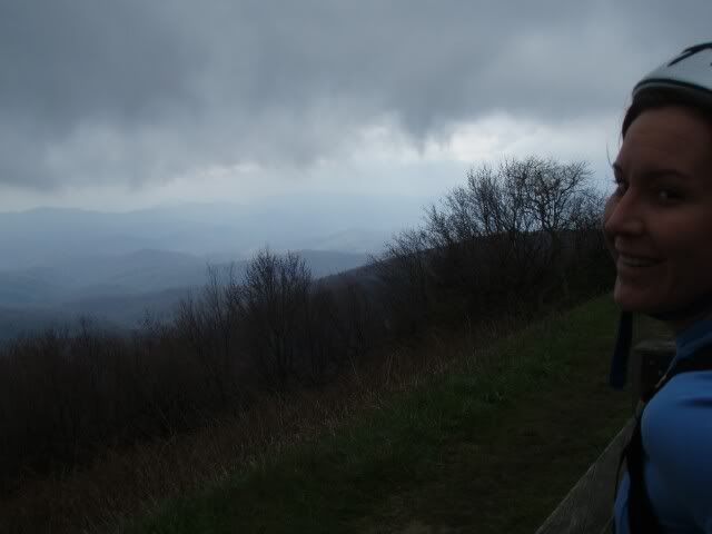
Erinna, Day 1, before the rain started: (click to see until -> goes away)

On Day 1 we saw many of these signs, but NOT many of the views they advertised:

The Linville Viaduct, a place with Wever family history:

After those photos the day got so intense.... Rain... Fog with less than 100' visibility... traffic... but morale was incredibly high. We were having a great time despite the conditions.
We stayed at the Switzerland Inn, in one of the A frames. I definitely recommend staying here:

Erinna is a badass (She's pretty damn cute, too). She carried a bottle of wine for us from Blowing Rock to Little Switzerland. Wine in styro cups in the A frame:

The new WaltWorks bike she was riding is badass, too.

Day 2 we woke up to a temps in the 40's, blue skies, and ominous clouds. For now, a sampling of the views from Day 2:


Day 1. 44 miles, 7660' climbing. Blowing Rock to Little Switzerland:
Day 2. 54 miles, 11,000' climbing (12,4' descending) Little Switzerland to Asheville:
Erinna, Day 1, before the rain started: (click to see until -> goes away)
On Day 1 we saw many of these signs, but NOT many of the views they advertised:
The Linville Viaduct, a place with Wever family history:
After those photos the day got so intense.... Rain... Fog with less than 100' visibility... traffic... but morale was incredibly high. We were having a great time despite the conditions.
We stayed at the Switzerland Inn, in one of the A frames. I definitely recommend staying here:
Erinna is a badass (She's pretty damn cute, too). She carried a bottle of wine for us from Blowing Rock to Little Switzerland. Wine in styro cups in the A frame:
The new WaltWorks bike she was riding is badass, too.
Day 2 we woke up to a temps in the 40's, blue skies, and ominous clouds. For now, a sampling of the views from Day 2:
I got out yesterday with Mike R. and Eric C. for a great day
in the woods.
1206->Laurel->Gnome->*walk*MountainstoSea*walk*->BRP->Big
Creek->Lower Trace->Fisherman's.
After a few delays on my part we met at the concrete bridge. Mike and Eric
weren't in a hurry and we finally got rolling at 1:00. Knowing the Big Creek is
usually a 4 hour loop we understood that any further delay would put us out
there after dark. The pace up 1206 was pretty high so we got to Yellow Gap in
just about 30 minutes. After a quick break we hit Laurel in high spirits and
fast pace. Water has returned to Pisgah so all the lower problems were
definitely unridable and we left inch deep tire tracks the entire way up the
hill. Somewhere after the meeting log I hit a wall and Mike and Eric rode away.
I think I was having a sugar crash after devouring that yummy frosted pop-tart at Yellow Gap.
Anyway, I shot an emergen-c and my energy level was up again for the $2000
climb. At Turkey Spring Gap we decided to continue on Laurel to the parkway
boundary rather than going Pilot Connector->Pilot and over to the Pisgah
Inn. That section of Laurel kicks ass. It sees so much less use than everything
before and is much much more tech. One thing that stands out in my mind was a
rock field along the way that was totally covered in moss. That place has a beautiful
and very wild feeling. Anyway, we walked the mountains to sea to parking lot
then descended the Blue Ridge Parkway to Little Pisgah Ridge.
When we got there
a dog was chasing cars, running out into the road, chasing cars INTO the
tunnel.... generally making bad decisions. It was a little blue heeler with a
harness and tags so after a few moments we decided to grab it and tie it to a
tree. It took a little doing, but it responded and came bounding to me and I
was able to grab it. Levi (we then learned it's name) was cookoo for chasing
cars so a brand new tube was sacrificed and a couple of slipknots later,
he wasn't going anywhere. We left a message at the number on the tag and decided
to come and get him if no-one called back. Next was the big descent of the day,
down Little Pisgah Ridge to Big Creek. We were running out of light so we made
our way down as safely and quickly as possible. We really didn't have time for
a flat or anything. About 2/3 of the way down we came across a hiker and
lo-and-behold, he was missing a little blue heeler. Sweet. He's tied up at the
top.
Mike led out for the entire descent and after a quick breather at Big
Creek we were on our way. The low-in-the-sky sun, plus the descent, and some
food had chased away any feelings of hitting the wall and I was in the groove for Big Creek. The Smokebike and 5" travel fork just ate
up all the rocks and corduroy, too. We flew down that trail, walked through the
creeks to save time, and made it to the reservoir before dark. Sometimes the
reservoir road takes forever, sometimes, like yesterday, it does not. We killed
it. In near pitch black we decided to take Lower Trace back to the vehicles and
that was exciting to say the least. Eric's night vision was failing him, Mike
and I rode like vampires. Well, until the water main at the river.... that
thing looked slick and scary. Cross the river and 100 yards later we were done.
5 hours with the dog incident and two breaks.
Subscribe to:
Posts (Atom)