Sunday, February 15, 2009

February 2009

Sunday, February 22, 2009
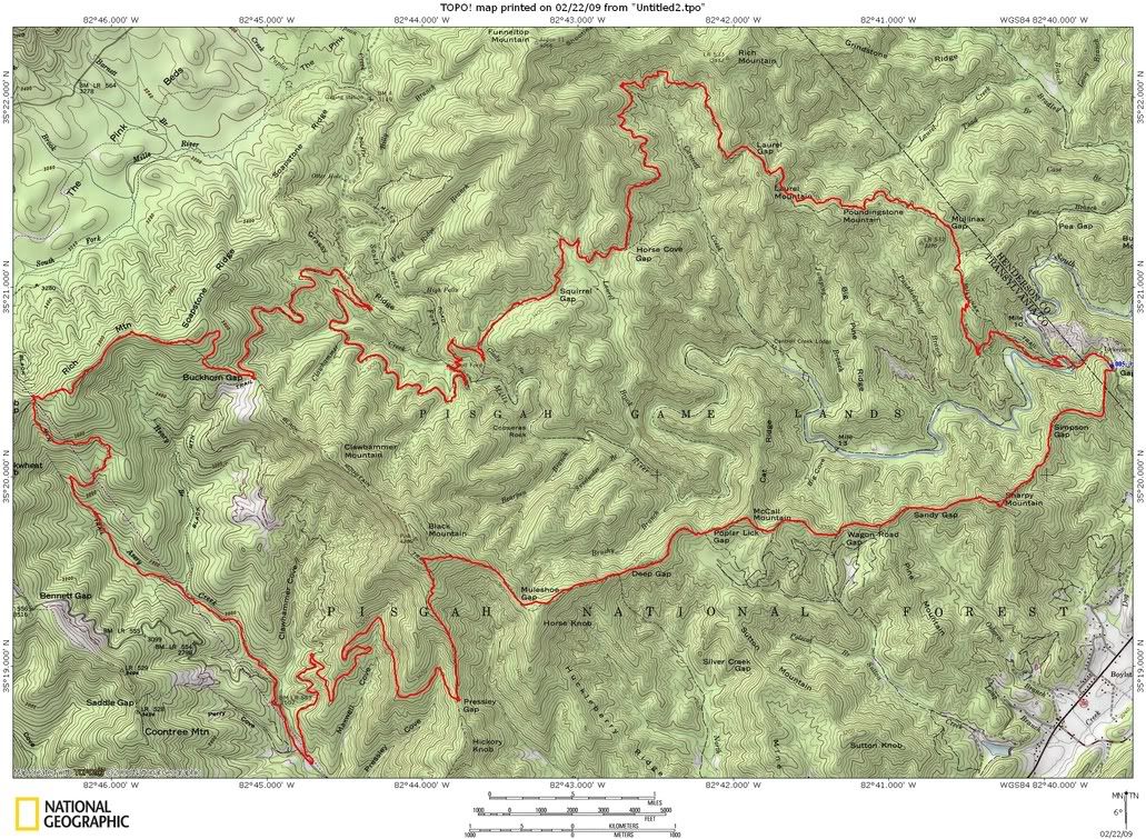
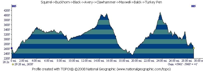
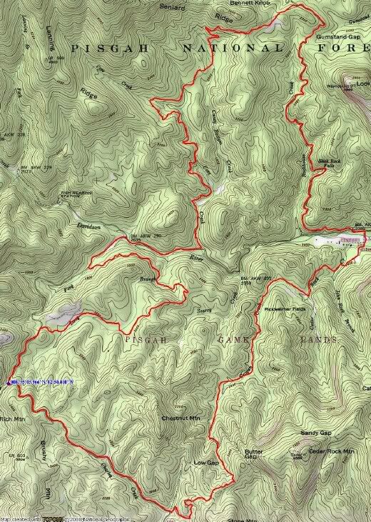
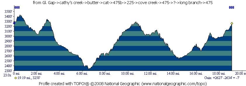
PMBAR training day 1.


29.2 miles 5960′ climbing

Posted by Eric Wever / Pisgah Productions at 23:22:33 | Permalink | Comments (6)

Breakin’ the cobwebs

Wode and I got out yesterday for an excellent ride. Clawhammer->Black->Buckwheat->Bennett.
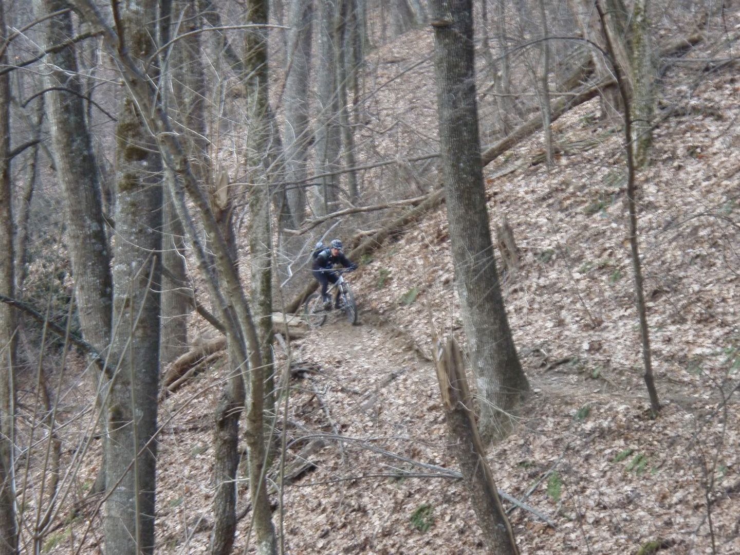
We met at Mr. Pete’s at 10am and were on the bikes around 10:30/11:00. The climb up Clawhammer was very tough, I had a hard time warming up and knocking the cobwebs out of my legs. I must have ridden up that road 100 times now and the landmark just kept clicking by, despite the feeling of a lack of power. We made it to the top together and without a break moved on to the shelter.
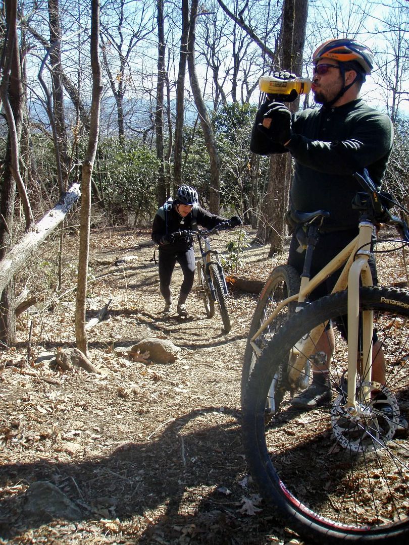
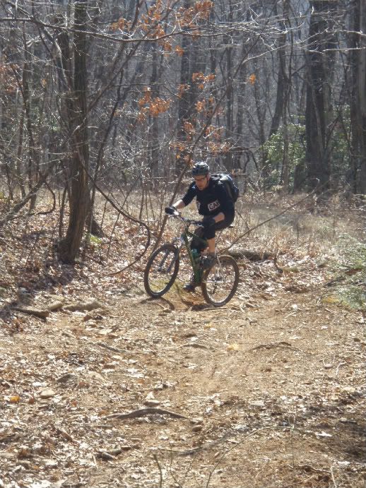
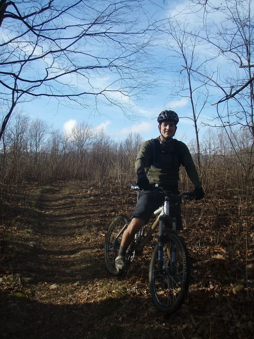
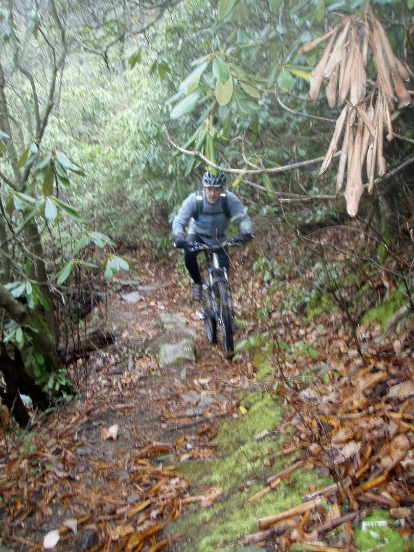
Wode on the way up Clawhammer:

Oh, on the way up a group of old guys were headed down the mountain. It was a great motivator, seeing guys in their 50’s and 60’s rocking on a Saturday morning. Yes, that will be me someday. Anyway, another group was leaving the shelter right as we arrived. Wode and I rested for a good 10 minutes or so before climbing the rest of the way towards Club Gap. The Smoke bike is really feeling great these days and I flew down the descents. Even though Wode took a good digger heading to Club the decision was made to do Buckwheat->Bennett and I’m glad we did.
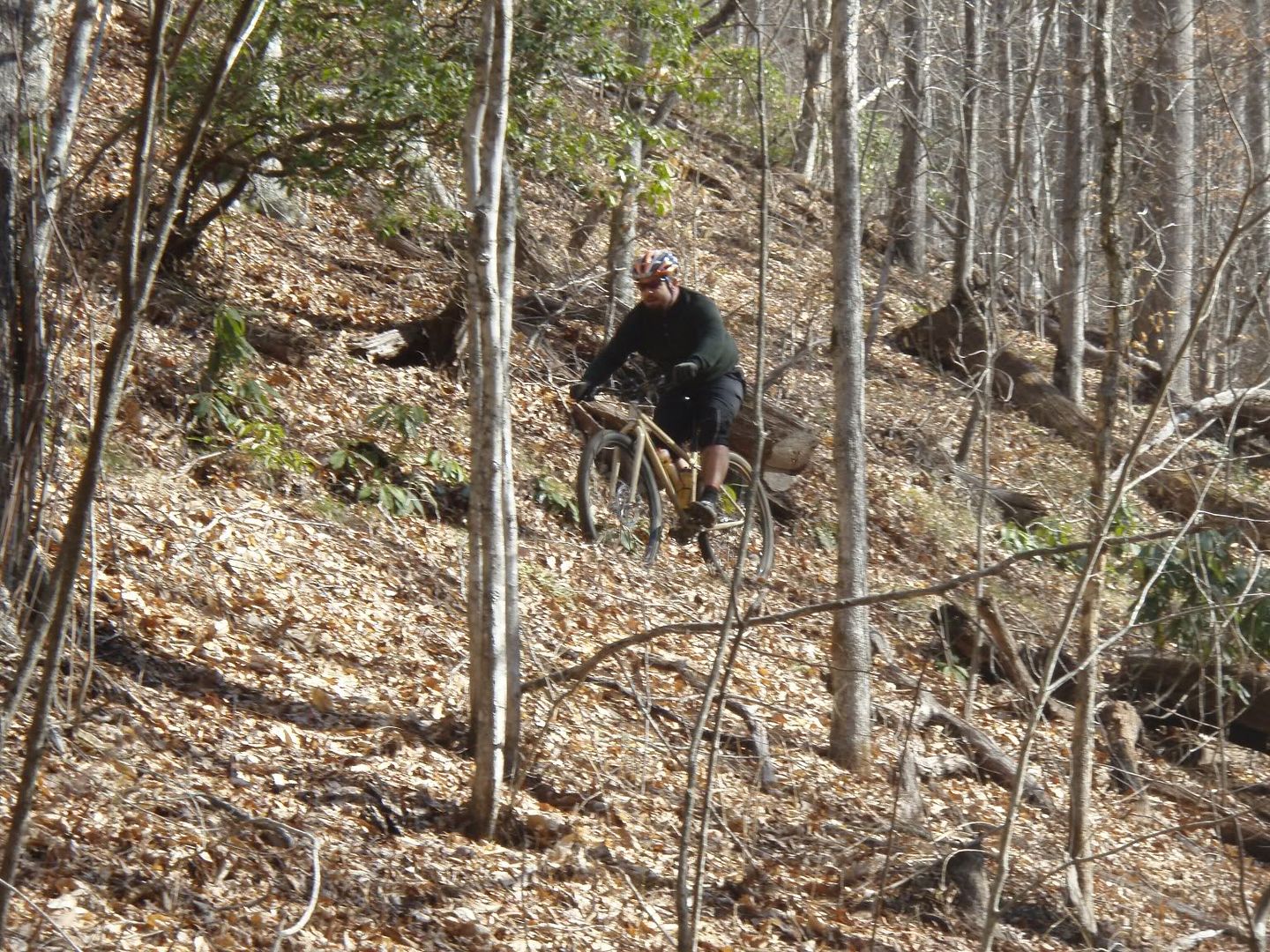
Wode and a BIG tree down on Buckwheat:

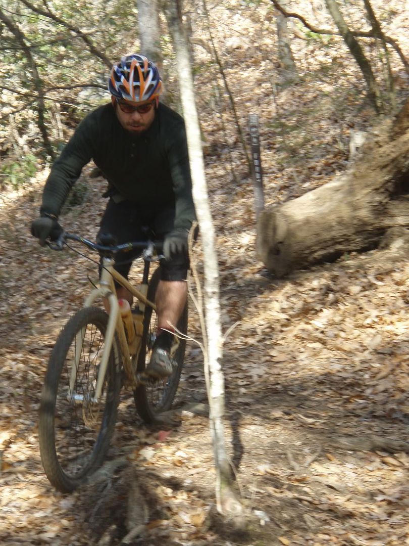
I kocked out both the Q-bert rock and, for the first time since I broke my helmet, the thread the needle. The trails were in great shape and the day had turned beautiful, 50*, no wind, crystal clear blue skies.

Well, the trail gave way to the freeze/thaw cycle and was a soup-pit at the very bottom of Bennett, but otherwise was in great shape. We caught up with the group of girls that had been at the shelter right as we hit 477 and we were back at the Jeep moments later. Great ride Wode! Thanks for making the trip up from the upstate!
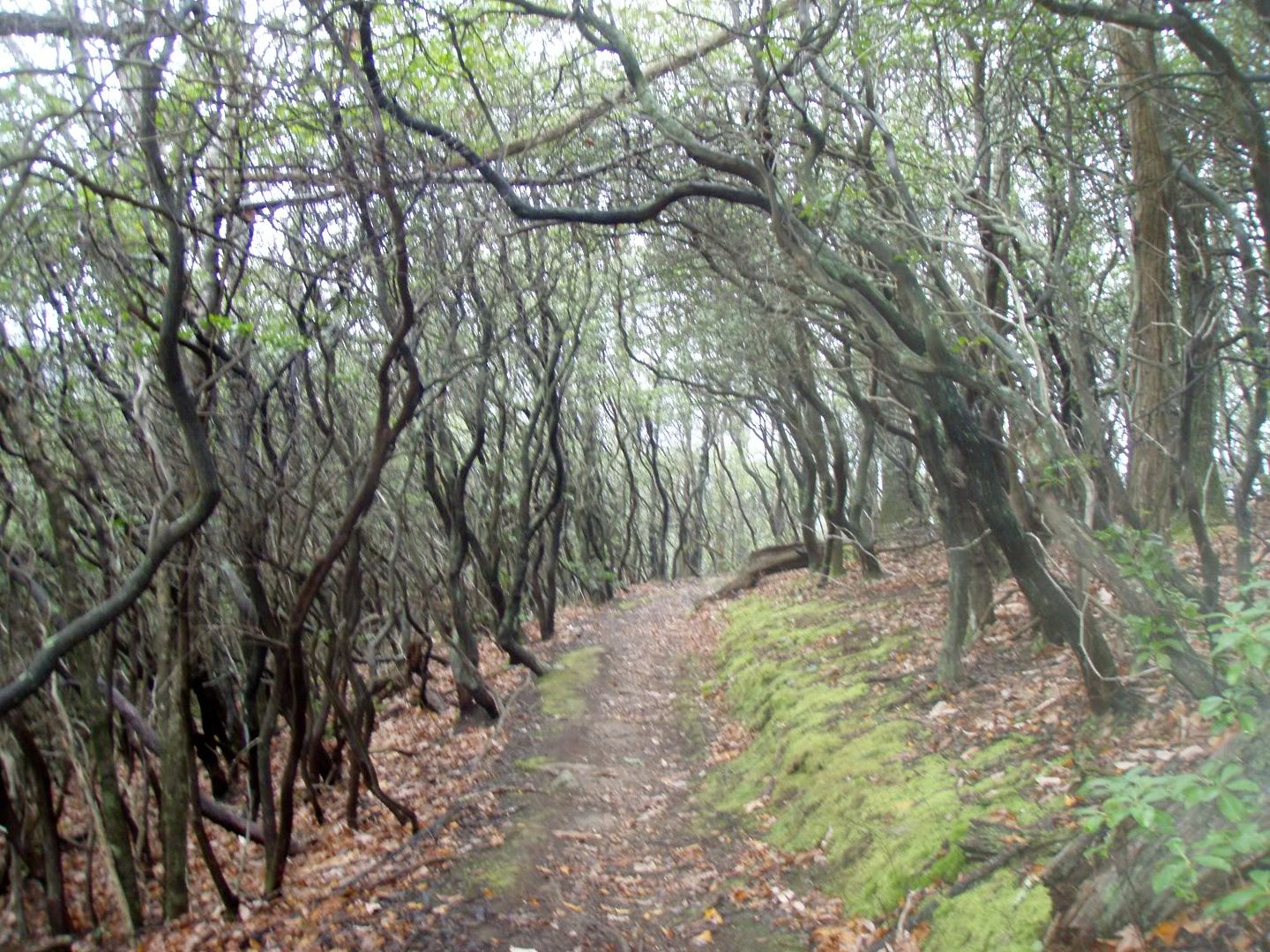
One more photo of…. well….I don’t know what sort of plantlife this is…but it’s cool looking:
Posted by Eric Wever / Pisgah Productions at 10:40:46 | Permalink | Comments (2)

Tuesday, February 17, 2009

Four Rides in Five Days!

I got out again today! This time with Dennis D. at Laurel Mountain. We started at Yellow Gap at about 10:30 under bright blue skies and temps in the upper 30’s/low40’s. It was Dennis’ first time on Laurel and actually, his longest ride to date. The lower part of Laurel, before Good Enough Gap, was thick with mud from freeze/thaw and the technical sections were wet. I went for a few of the tech moves though and Dennis was never far behind. After the meeting log the ground was frozen and we were even greeted by a fresh half inch of snow a bit further up.

Even with the first tracks in new snow we kept the pace comfortably high and made our way to Pilot with hardly a break. Upper Pilot was also snow covered but by the time we hit the quadswitchback the ground was surprisingly dry. Dennis was doing great, trying every switchback and technical move on the way down. He even went back and tried a steep step down a second time and came out of it with success and a big smile. We stopped at the overlooks and I got Dennis to shoot a vid of me running the humvee section.
Is it the 5″ travel fork or has someone sanitized the rockgarden on Pilot????? It was too easy today.

I got a flat after humvee and the route was taking a little longer than expected. I could tell Dennis was a little tired, and frankly, after yesterdays DuPont ride so was I. Rather than just taking no-name to Pilot Cove I gave Dennis the option. Like a trooper he chose the extended singletrack route rather than bail to the road. Along the way he had a bit of a cramp that an emergen-c took care of. Turn onto Pilot Cove, descend to 1206, descend to Bradley Creek….. then the final grunt back to the Jeep…. The final climb to Yellow Gap is never easy. Sometimes it’s faster than others, but it’s never easy. After that mile or so…. we were done. Great job Dennis! Thanks for coming out!

Posted by Eric Wever / Pisgah Productions at 00:18:58 | Permalink | Comments (1) »

Monday, February 16, 2009

Otto’s DuPont Loop

Mike B and I made plans last night to ride today at DuPont. The noon rally time arrived with Ian B. at my house as well. Ian drove (he has the best racks) and as soon as we got to the trailhead Otto was there just getting ready to head out. I thought to myself ‘Aw hell…. Last night I didn’t sign up for a fast guy ride’ but, I need to get into shape and there’s no better way to do that than ride with folks faster than you. The route for the day:
from guion parking->hickory mtn rd.->ridgeline->jim branch->issac heath->buck shoals rd->staton rd->pinetree->rock quarry rd.->micajah->wilke->corn mills shoals rd->upper burnt mtn->burnt mtn->big rock->cedar rock->little river->corn mill shoals->laurel ridge->mine mountain->reasonover->julia rd->conservation rd.->buck shoals back to the parking lot.

24.2 miles, 3420′ climbing.

Posted by Eric Wever / Pisgah Productions at 00:22:55 | Permalink | Comments (4)

Saturday, February 14, 2009

From the parking lot at work….

Green Dot, Blue Square, Black Diamond, Farm, Arbor Trace. Just over 15 miles.

Posted by Eric Wever / Pisgah Productions at 00:08:25 | Permalink | Comments (1) »

Friday, February 13, 2009

Biltmore!

I hit the Biltmore trails today, my first ride in a couple of weeks. I’ve got a ton of excuses as to why I haven’t been out but it really boils down to the fact that my back has been jacked since the Icycle downhill and I’ve had a good case of the lazies. Oh, Erinna and I hosted a race this past weekend, too. That usually means a weekend off the bike. Anyway, after a few invites for evening/night rides and a call back into work I decided to just hit the trails that are right at the back of the parking lot that I drive to almost every day. There’s only about an hours worth of trails out there total but, while I was riding, I kept thinking ‘This is as good as any city park I’ve been to’ and ‘I’ve got no excuse for being out of shape.’ and ‘I’m a dummy for not using this resource.’. Anyway, I’m going to try to hit it again tomorrow, GPS in tow. I’ve got no good excuse not to!

*edit* The Biltmore Estate is private property. You need a ticket/pass to get in. Guests/Passholders/Employees/Contractors need to contact the Outdoor Center regarding access to the trails. Seriously.

Posted by Eric Wever / Pisgah Productions at 00:29:59 | Permalink | Comments (1) »

Tuesday, February 3, 2009

Icycle 2009

12 runs or so down the Turkey Chute…

Crap. I just lost my write up of this event.

Thanks Brad for the invite, J for the ‘yougottabethereman’ phone call, and Mike R. for the ride and the awesome photo above.
I had a great weekend of riding and hanging out with friends. I rode to the top of the downhill course 3 or 4 times, sketched up the hill on Bill G.’s truck once,: (photo from mtbr)

and rode the boxtruck up the hill at least 6 or 7 times after that. Here are a few photos from the truck ride up to the start of the downhill.
Michael M. was there. Can you spot his bike?

The other (safe) end of the truck:

annnnnnnd….. Jody:

Ok, the lost write up talked about a big party, mud-breakdancing, rental cabins, mullets, night riding, and the like. But….all I’ve got in terms of photos of the party is this. Man, it was a funking party! Whooo!!! Broussard nomnomnom’n on some spagettio’s. Don’t ask why he’s naked.

Posted by Eric Wever / Pisgah Productions at 20:39:59 | Permalink | Comments (2)


Thursday, January 15, 2009

January 2009

Monday, January 26, 2009

Kitsuma? Again?

Yes, twice in less than a week I’ve hit Kitsuma. This time with Dennis D.


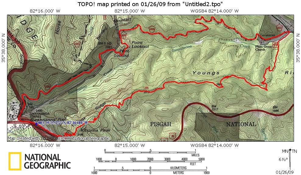
sweet… the gps says I got up to 36mph at mile 4.3, just before the campground. That’s movin!

Posted by Eric Wever / Pisgah Productions at 20:02:18 | Permalink | Comments (1) »

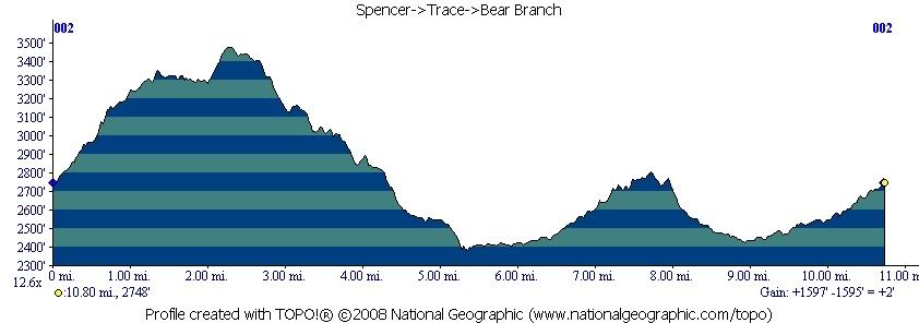
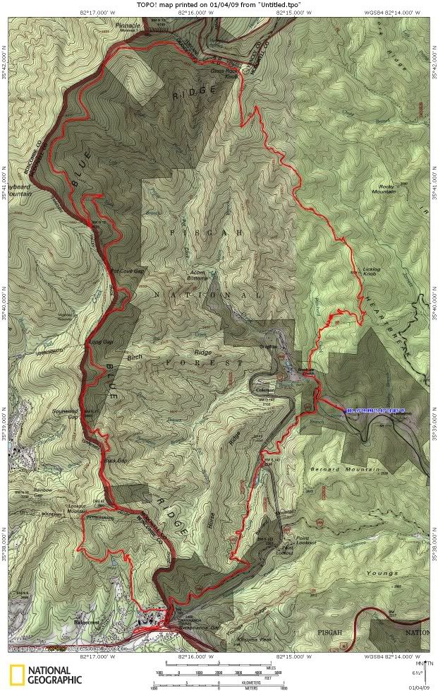
SpencerTraceWashBearPony

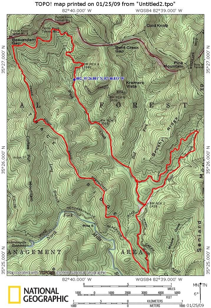
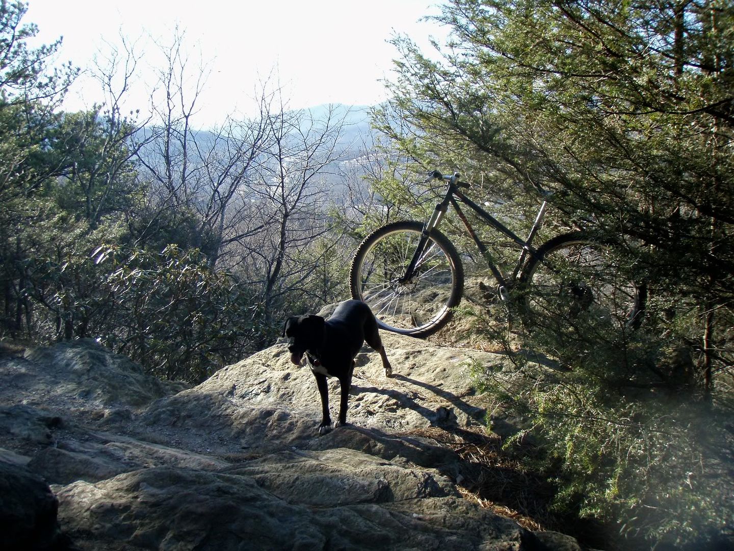
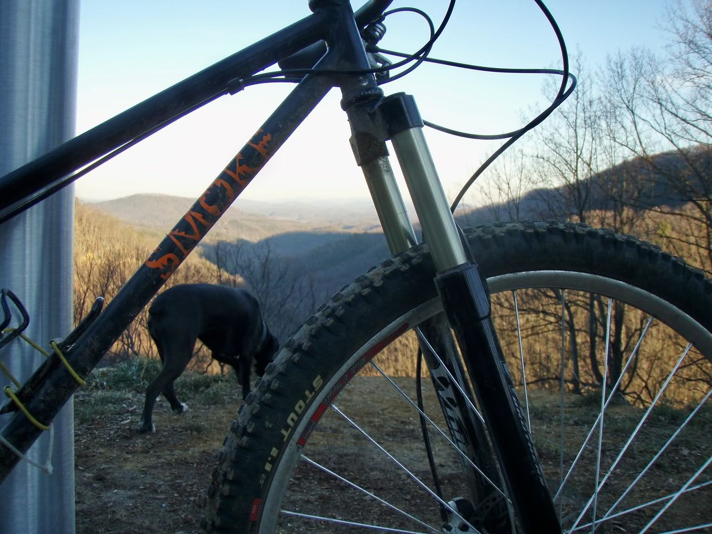
5000->Spencer->Trace Ridge->Wash Creek->5001->Bear Branch->5000 back to the B.A.T. (Big Ass Truck) with the one and only Lee Oh Knee Pony.

Posted by Eric Wever / Pisgah Productions at 00:00:58 | Permalink | No Comments »

Thursday, January 22, 2009

K I T S U M A

Wooooooo!!!! Yeeaaaahhhhhh!! WoooHoooo!!! Man o man Kitsuma rocks. Sophiedog and I just got in after knockin’ it out in just under 90 minutes. That’s with multiple stops and Sophie halfbonking at the end! Afer almost three weeks off the bike due to sickness, travel, and bittercold weather I arrived at the Kitsuma trailhead at 3:30 today. When I got there I was ready to go except almost all of my water had drained out of my camelbak. doh! Well, not to be deterred I took just a couple sparing sips and headed up the swithbacks. I passed a group of college kids with a gorgeous pitbull and cleaned all but the last couple switchbacks before the interstate overlook.

I was surprised that after only a short break they were at the overlook, too. Sophie and I hammered to the top and without a stop attacked the first descent. Oh, before I forget, the climb to Kitsuma peak was in better shape than I’ve ever seen it. Anyway, I attacked the first descent, wheelie dropping the stepdowns without fear. The trail was feeling groomed…. (oh, wait, maybe it was my 5 inch travel fork??? ;) )Then the next climb was there sooner than I expected. That’s the way it is in Pisgah… Someone will say ‘yeah, xxxtrail is a great descent.’ what they mean is, except for that big-ass climb in the middle, xxxtrail mostly goes downhill. I checked-up on Sophiedog every chance I got during the descents but…. really let it hang out when I wasn’t checking-up. Erinna’s words rang in my ears ‘who’s going? Just you? BE CAREFUL.’ Thanks Sweetie. I was just careful enough to not get in trouble. I did, however, go back and hit the new bigbad log launch…. and pulled it clean as a whistle. Another climb, surprise switchbacks? wha?
I guess it’s been a while since I’ve ridden Kitsuma… more rock&roll descending, the two righty deep roll-ins, whoa! that jump’s too big! and we were at the picnic area. Just good ‘ole Old 70 back to the Jeep ahead. Another surprise awaited me there, I had heard about new asphalt but was unprepared for the roady backwoods experience that now is Old 70. A perfect one lane ribbon of asphalt has been laid from one end to the other. It takes away any trail-like atmosphere…

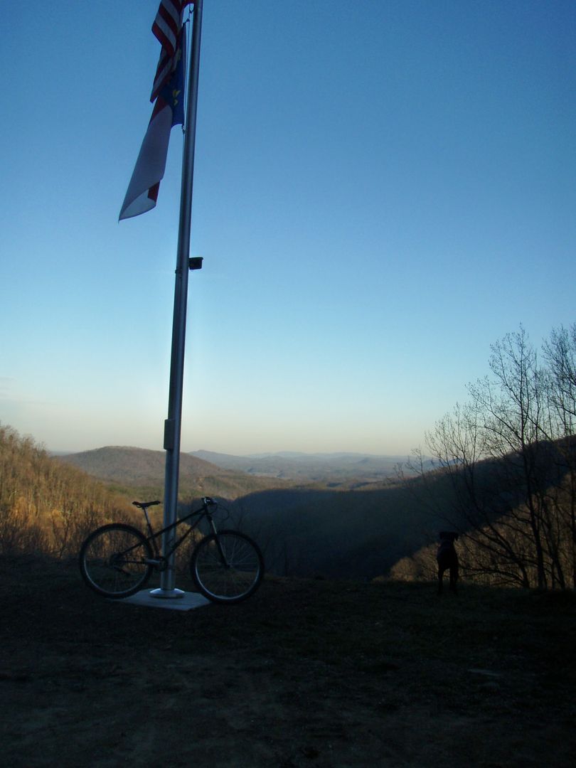
but… holy crap is it FAST! A couple of photos later…

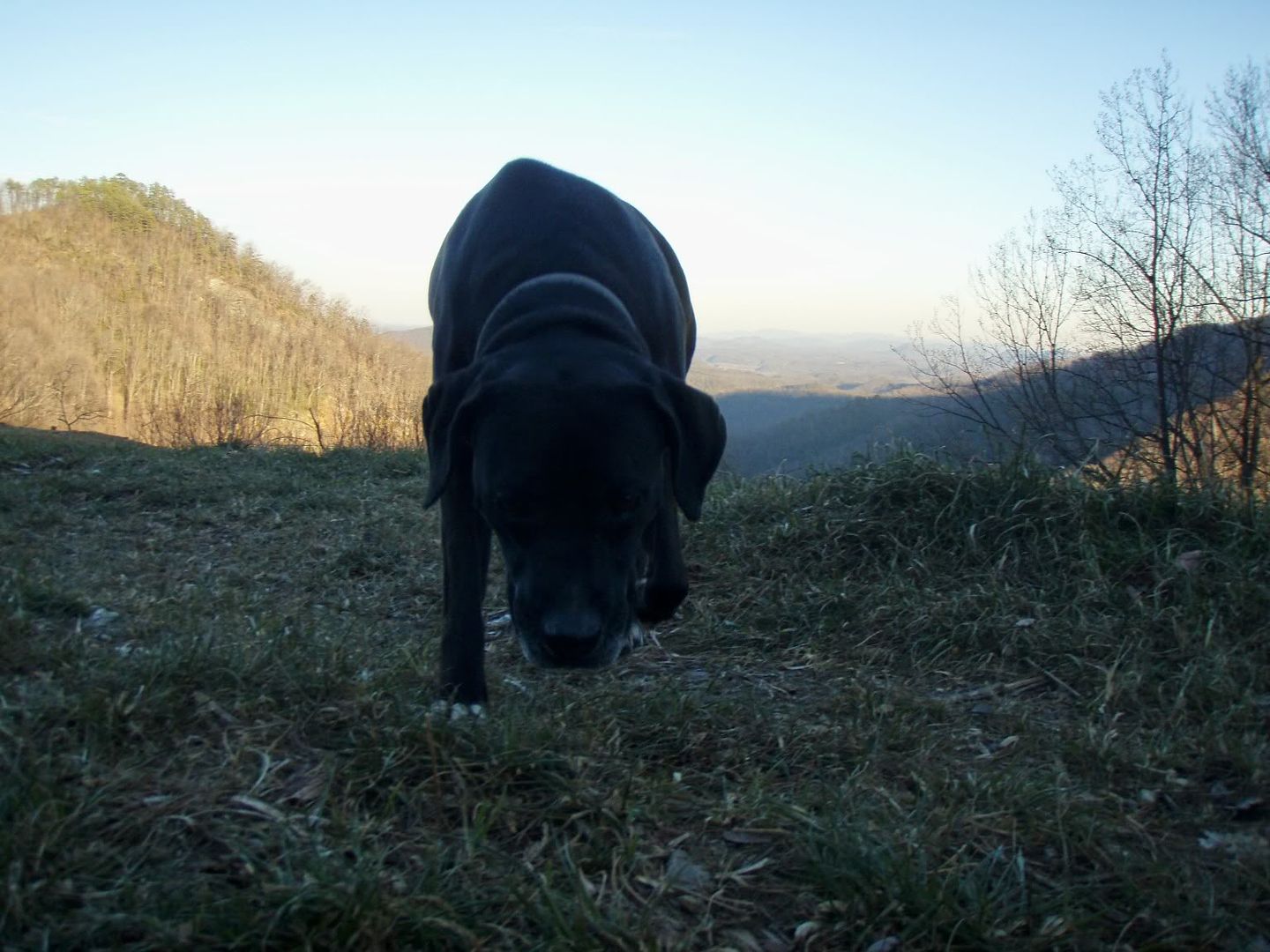
…we were on the open road. I had forgotten a leash so, that piece of blue twine that I found on the side of the road would do….. back to the car just before 5PM. Kitsuma. A great way to get back on the bike.

Posted by Eric Wever / Pisgah Productions at 22:53:22 | Permalink | Comments (2)

Sunday, January 4, 2009

Festivus 08/09 ride.

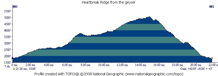
For more years than not since I met Bill, Rich, and Clint I’ve done a ride with some or all of them sometime right around new years day. It’s a tradition that’s held up for just as long as any other seasonal tradition that I look forward to. This year it was just us plus Mike B. We started at about 9:30 at the Andrew’s Geyser for Heartbreaker. Old Toll road opened on the 1st so that’s the way we went up.

Heartbreak Ridge descent part 1.

Heartbreak Ridge descent part 2.

Heartbreak Ridge descent part 3

Heartbreak Ridge descent part 4

Posted by Eric Wever / Pisgah Productions at 20:08:47 | Permalink | No Comments »

Saturday, January 3, 2009

First Ride of 2009

I got out yesterday with Mike R. and Eric C. for a great day in the woods. 1206->Laurel->Gnome->*walk*MountainstoSea*walk*->BRP->Big Creek->Lower Trace->Fisherman’s.

After a few delays on my part we met at the concrete bridge. Mike and Eric weren’t in a hurry and we finally got rolling at 1:00. Knowing the Big Creek is usually a 4 hour loop we understood that any further delay would put us out there after dark. The pace up 1206 was pretty high so we got to Yellow Gap in just about 30 minutes. After a quick break we hit Laurel in high spirits and fast pace. Water has returned to Pisgah so all the lower problems were definitely unridable and we left inch deep tire tracks the entire way up the hill. Somewhere after the meeting log I hit a wall and Mike and Eric rode away. I think I was having a sugar crash after devouring that yummy frosted pop-tart at Yellow Gap. Anyway, I shot an emergen-c and my energy level was up again for the $2000 climb. At Turkey Spring Gap we decided to continue on Laurel to the parkway boundary rather than going Pilot Connector->Pilot and over to the Pisgah Inn. That section of Laurel kicks ass. It sees so much less use than everything before and is much much more tech. One thing that stands out in my mind was a rock field along the way that was totally covered in moss. That place has a beautiful and very wild feeling. Anyway, we walked the mountains to sea to parking lot then descended the Blue Ridge Parkway to Little Pisgah Ridge.

When we got there a dog was chasing cars, running out into the road, chasing cars INTO the tunnel…. generally making bad decisions. It was a little blue heeler with a harness and tags so after a few moments we decided to grab it and tie it to a tree. It took a little doing, but it responded and came bounding to me and I was able to grab it. Levi (we then learned it’s name) was cookoo for chasing cars so a brand new tube was sacrificed and a couple of slipknots later, he wasn’t going anywhere. We left a message at the number on the tag and decided to come and get him if no-one called back. Next was the big descent of the day, down Little Pisgah Ridge to Big Creek. We were running out of light so we made our way down as safely and quickly as possible. We really didn’t have time for a flat or anything. About 2/3 of the way down we came across a hiker and lo-and-behold, he was missing a little blue heeler. Sweet. He’s tied up at the top.

Mike led out for the entire descent and after a quick breather at Big Creek we were on our way. The low-in-the-sky sun, plus the descent, and some food had chased away any feelings of hitting the wall and I was in the groove for Big Creek. The Smokebike and 5″ travel fork just ate up all the rocks and corduroy, too. We flew down that trail, walked through the creeks to save time, and made it to the reservoir before dark. Sometimes the reservoir road takes forever, sometimes, like yesterday, it does not. We killed it. In near pitch black we decided to take Lower Trace back to the vehicles and that was exciting to say the least. Eric’s night vision was failing him, Mike and I rode like vampires. Well, until the water main at the river…. that thing looked slick and scary. Cross the river and 100 yards later we were done. 5 hours with the dog incident and two breaks.

Posted by Eric Wever / Pisgah Productions at 15:29:27 | Permalink | No Comments »


Monday, December 15, 2008

December 2008

Saturday, December 27, 2008

Looking Glass Rock Loop

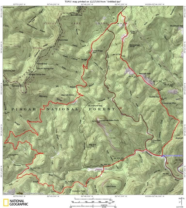
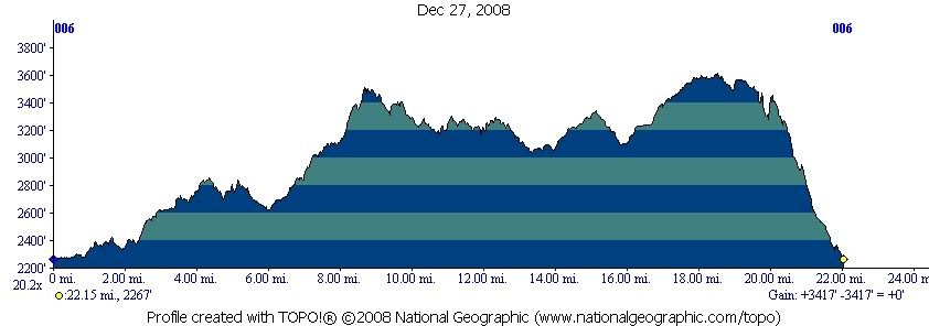
Mike R. and I got out for another excellent ride today. Starting at Coontree picnic area->276->475->Cat Gap->Long Branch->5095->475->5046->Daniel Ridge->225->475B->276->477->Bennett Gap->Coontree Loop->to the Jeep.

The day started with pavement and the idea that we would head up Cove Creek trail. Somewhere along the way I thought ‘why not head up Long Branch and find our way to 225 some other way?’. Mike is un-phased by spontaneity and just like that we were headed up the slimy muddy logwaterbarcovered climb towards Long Branch. The pavement was a great warm-up and we both tried our best to clean as much as we could. I tried the rockdrop a couple of times but decided to stay away from the high point, it was still early. The climb up long branch was full of spinning tires in two inch deep muck and climbs that were harder than I had remembered. We took a quick breather at 5095 then descended (mostly) to 475. The trails were in nasty shape today and highspeed technical descending was probably not a good idea. We did, however, get highspeed riding in today. That gravel road was the first great descent of the day. Not tech but FAST and when moving FAST in slippery conditions…. old gated doubletrack was tech enough. Next we turned at the Daniel Ridge parking lot and started to climb another old gravel road. We passed by both Daniel Ridge trailheads, climbed past the redblaze connector, and were again surprised by the steep, unrelenting climbs. We turned on upper Daniel right after the waterfall:

(I did remember that climb was coming) and took the connector upupup to 225.

It was the first time in memory that I had taken 225 headed to 475B. In the wet and slimy conditions the descent was superfast, superfun, and supersketchy. I plowed my front wheel at a 45* through one turn…. without turning a bit. The resulting mark was easily 25′ long. After 225 we climbed 475B past CaseCamp then descended to 276. Another plan change at that point, I was feeling fatigued and asked Mike what he thought of just 477 to Bennett rather than 477->Club->Buckwheat->Bennett. He was cool with it so the climbing resumed after another quick breather at 477. When we got to Bennett there was a family of like, 25 people…. kids to grandmas having a weekend after Christmas campout. That was decidedly odd, even on this beautiful 60* threatening clouds and bright blue skies day…. but after a couple of hello’s we were climbing the false-climb up and over Bennett.

We took it easy but I still knocked out the Qbert rock.

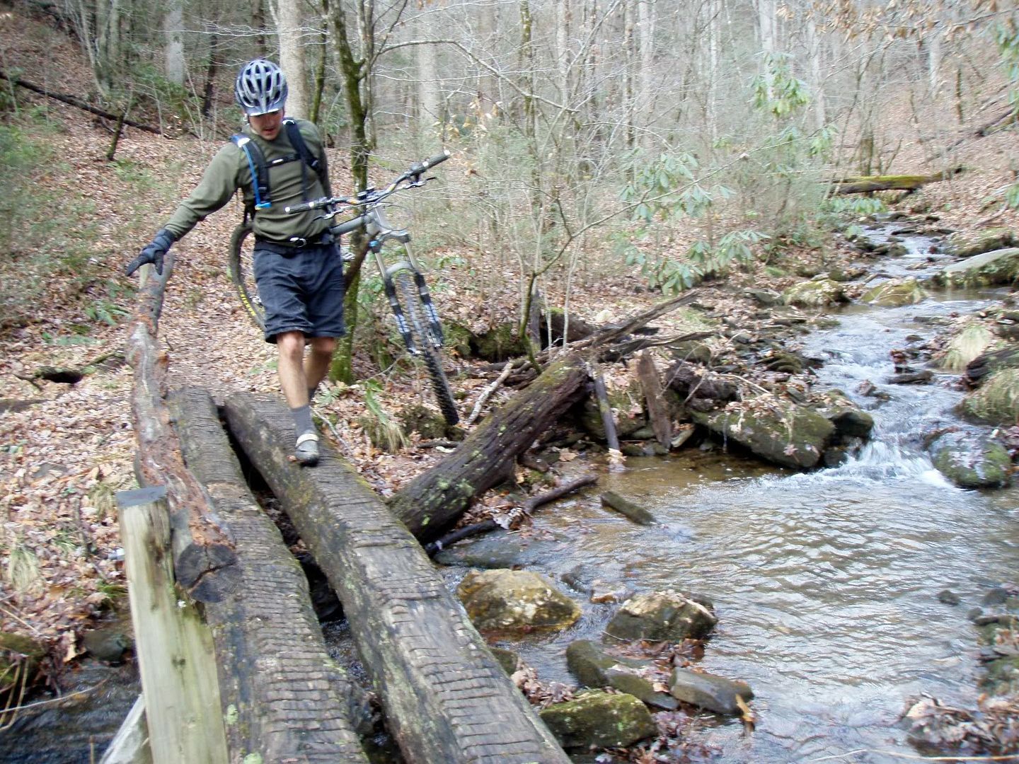
The thread the needle was still daunting after the last time I was there so…. I walked that one. The final descent wasn’t the fastest either but was as fun as ever. I hopped the logs, wheelie dropped from here to there again and again, and with big smiles we turned onto Coontree without a break. Coontree is tech, steep, and fast fast fast all the way back to the Jeep. Well, there are a few creek crossings to walk towards the bottom:

Great ride on a beautiful early winter day. Completely new loop for the both of us.

Great to see you back on the bike, Mike.

Posted by Eric Wever / Pisgah Productions at 21:59:06 | Permalink | No Comments »

Wednesday, December 24, 2008

Turkey Pen: warm, dry, and sunny? on Christmas Eve?

Pfft…Never.

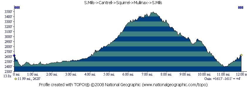
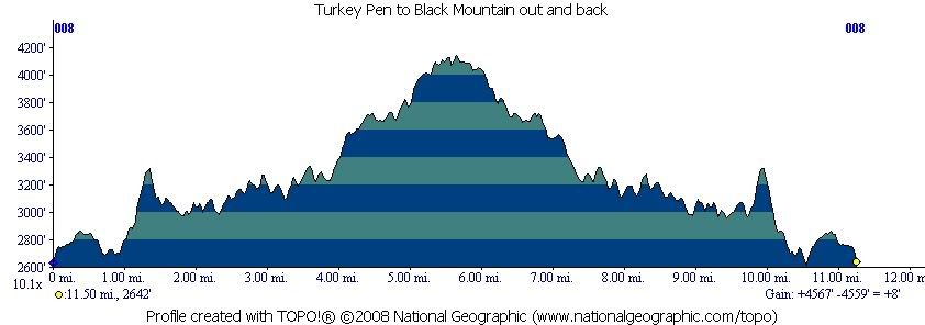
Turkey Pen is always cold, wet, and cloudy. Today was no exception. Mike R. and I got in a great 2.5 hour ride: S. Mills River->Cantrell Creek->Squirrel Gap->Mullinax->S.Mills River back to the vehicles. Erinna and Sophiedog came along also and ran out and back on Turkey Pen to Black Mountain. We started at the same time, and as Erinna had predicted, finished at the same time. It was one of those magical Pisgah timing experiences!

Just under 12 miles, Just over 1600′ of climbing.

Compare that to my badass wife’s day:

That’s right. Over 4500′ of climbing (2900′ more than us) in just about the same number of miles….. on foot.
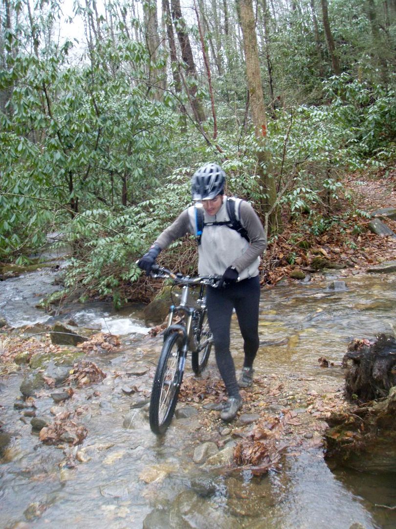
Here’s Mike keeping his feet dry on Cantrell:

C’mon man…. all the cool kids are doing it….

Squirrel Rhodo tunnel:

Mike on Squirrel:

We show up from one direction, she shows up from the other. Amazing.

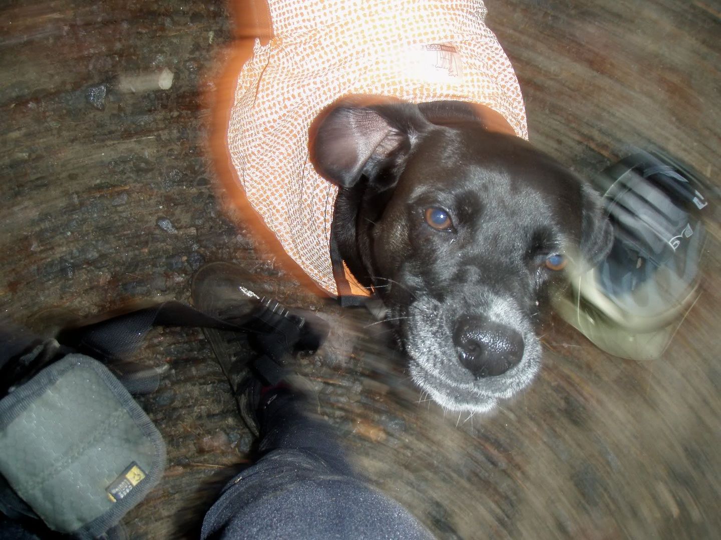
and Sophiedog!

Posted by Eric Wever / Pisgah Productions at 20:09:41 | Permalink | No Comments »

Saturday, December 20, 2008

Fine Fall Fish-Hatchery ride… solo.

Erinna ran the entire Art Loeb trail today. Here’s a photo of one of the many big views she had:

and one more shot… last weekend was the Warren Haynes Xmas Jam. Erinna and I worked late into the early morning three nights in a row. We saw a ton of great music and ran into more friends than we ever expected.

Posted by Eric Wever / Pisgah Productions at 17:30:31 | Permalink | Comments (1) »

Sunday, December 7, 2008

and introducing the star of our show….. THE PONY!

I got out for a fun frozen ride today with a group of great people. Ian ‘the pony’ L., Wode, Mike B, Jody F., Wes M., and I got started around 10:30 in sub-freezing temps at N. Mills River Campground. The route for the day: 1206->Laurel Mountain to Turkey Spring Gap….. then we retraced our steps all the way back to the vehicles. It was Ian’s first mountainbike ride in months so the pace was super slow…. but mission accomplished: a fun group went out on a super cold day and had a great time.

The Pony at Yellow Gap:

Super Wode…. ready for action.

Zen and the art of enjoying the day:

Jody and Wode heading up Laurel:

Wode at the $2000 climb:

Posted by Eric Wever / Pisgah Productions at 23:41:00 | Permalink | Comments (4)