Saturday, June 30, 2012

What am I doing here?


Last night I got out for one of those rides that I hope never fades from my memory. It was that good. I started on the All-Road bike from the Fish Hatchery at 9:30pm. My route for the evening: 475->Indian Creek->215->140->140A->5003->475.

can anyone tell me why my Garmin device has one set of stats but Garmin connect publishes different data?

The climb up 475 has been getting easier and easier for me lately and I was at the Gap about 40 minutes after I started and I was feeling great. Without a break I continued on until Indian Creek Rd.
 I took a nice little break there and contemplated heading down the pavement but took the only sensible option, the gravel (up and) down to NC215. Right as I was approaching Balsam Grove I was descending at about 25ish mph and flatted. I had been listening to Phish 6/28/12 the entire ride thus far but had to pop the earbud out. I could hear horses but couldn't see them and I saw dog eyes moving slowly towards me and his friends making a racket off in the distance. It was one of my fastest tube changes yet.
 As soon as I got on the bike I could hear the stealth ninja dog chasing me. Thank God it was downhill from there because every hair on my body stood on end and I hauled ass with shaky legs. I turned onto 215 feeling exhausted as the adrenaline rush faded but I didn't take a break until 140A.
 I walked a good portion of 140A and considered adding it to the Pisgah Monster Cross Challenge. People would love me or hate me if I did that. I don't think there would be any in between. I stopped briefly at 5003 for a snack but really just continued on after just a few minutes. I was then riding my roadbike in three foot tall grass, stinging nettle, and blackberry briars
 and was loving every second of it. 5003 is spectacular at 11:30 at night. I saw an owl stop and check me out, I hit 30mph, and I was back at Gloucester Gap quicker than I had anticipated getting there. Down 475 at full speed ahead (but cognizant that I had no more tubes) then Davidson River trail to finish the ride. A great evening on the bike!

Sunday, June 24, 2012

It was a dark and stormy night...

Mike B. and I got out late last night for an excellent ride. From the Daniel Ridge parking lot->475->5003->140A->Farlow Gap->Daniel Ridge. 13.3 miles with 3766 ft of climbing.... or something like that.
 Yesterday morning I read the Adventures with the Pisgah Gnome thread and decided it was time to get Sam on the move again. Erinna was at work until 7:30PM so I called Mike B and asked about a 8:00PM rally at my house. He was game and a little after 8 we were headed to Daniel Ridge.
We arrived to unexpected rain and no sign of the others that said they may or may not join us. After leaving a note for those that were not going to show we were headed up 475 with the rain breaking and beautiful orange crescent moon rising. We kept the lights off for the entire climb to Gloucester Gap and it was a great way to warm up.
 That first climb went by quickly and 5003 started out equally paced. The rain had soaked the trail and the line choices all included getting wet. You could take the track and ride in a flowing temporary creekbed or in the middle, in two foot tall wet grass. The temps were hovering right around 70* so the 10K% humidity didn't bother us at all. 
We finally took our first breather about a mile from the turn so when we DID arrive at the turn we only stopped briefly for a few photos and to look at my phone to reference the photos of where the gnome was hiding out. 
2/3 of the way up, look for a fork in the trail, at a shallow creek crossing look for a rock overhang 100' up and off the trail. Like we were ever going to be able to see 100' up the trail..... pfffft. Without much hope that we were actually going to find the spot we dropped into the granny and started the much harder climb up 140A. We held together for the first mile or so of 140A but fatigue started to set in on me and Mike slowly pulled away. We stopped and regrouped a couple of times

so he was never too far ahead, 

and I would catch glimpses of his light, but I was just trucking along at my own pace, looking for the fork in the trail. I didn't see that but I did immediately recognize the shallow creek crossing from the photo. I yelled forward and Mike was climbing over a log 100' ahead so he heard my call. 'I think this is the spot!' and Mike came back up to where I was standing, verified my thought, and we were off the bikes.... Gnome Hunting.
I scrambled up one way through the stinging nettle. Mike another. The spot was beautiful with plants of all sorts and moss and rocks and roots under foot for every step.

 It took only about 5-10 minutes for Mike find the out cropping and another 5-10 for me to plod through the moss covered rock field between me and him. A little more poking around and Voila. We found him. Time: 11:00PM

 I strapped Samford onto my back

 and we were at Farlow Gap about 35 minutes later. We took a longish break there 

then headed down one of the gnarliest chunderful trails I know of, here or elsewhere. We made the promise at the top though that there were to be no big moves or big risks, that as wet and late as it was we needed to just keep two wheels on the ground. What followed was some of the best mountainbiking I've experienced in years. Slow tech rock gardens with roots more treacherous than the rocks that normally would be the reason you need to worry. Slippery when wet. It's great to have friends that seek adventures like the one we were on last night. Anyway, Mike made the suggestion that Samford the Gnome should hang out below the waterfall on Farlow so once we got there we hiked down the SUPER sketchy trail to down below. We instantly found his new home then scrambled back out of there.

 We found a much easier way back up the sketchy trail than the one we used to get down then continued on Farlow. Up through the camp then onto the relatively easier lower section before the steps. We both said NO WAY to riding the steps then climbed through the last creek and were on our way to Daniel Ridge. Again I was thinking that these trails, right then, were some of the best anywhere. Mountainbiking at it's very finest. As we descended Daniel we became immersed in fog and to say the descent was a challenge would be an understatement. We arrived safe and sound though and crossed over the big bridge and back into the parking lot just over 4 hours after we started. Not bad for my first REAL mountain ride since my last crash plus gnome hunting and hiding and the fact that we were finishing up past 1:00AM! Thanks for getting out there Mike. That was fun.

Tuesday, June 19, 2012

Urban Gravel

From West Asheville-> Clingman->Hilliard->Downtown->Charlotte->Macon->Old Toll->Sunset->Patton Mountain (gravel)->Town Mountain->Webb Cove (gravel)->Beaverdam->Merrimon->WTWeaver->Broadway->Riverside->Craven->Waynesville->Back to West Asheville.
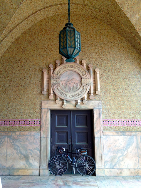
The City Building:
From Patton Mountain Rd:
The West Asheville art park
Hank, Merle, and Waylon:

Sunday, June 17, 2012

Party Time!

I just walked in from a Father's Day ride to find my baby asleep and my mother-in-law doing our laundry. How great is that?!?!?
I'm in the market for a full suspension 29er and today I got out and tried the Specialized Stumpjumper. The route for the day: 5000->Spencer->Spencer->N.E.R.->Fletcher->Middle Fork->Upper Middle->Big Ridge->Big Creek->Res. Rd.->Wash Creek->5000.. The GPS died along the way so I don't have any stats.
 Real quick, a few thoughts about the bike: The Small fits me perfectly. There was only one time (during the Spencer descent) that I questioned that. It felt like I was on my way over the bars for a moment there. That could easily be my gunshyness showing through. The bottom bracket is a little low for my tastes, too. I think that probably will be the case with any 120mm 29er I get on though, otherwise the saddle would be too high for me to mount the bike. Positives? It's stiff. No doubt about it. It climbs like a billygoat. I cleaned all of Spencer up and Big Ridge. It's stable at speed. It's stable at no speed. It's great in switchback descents, too.
 I don't have any other real ride notes expect it was an absolutely beautiful day to be in the woods. 75 degrees with bright blue skies and fluffy clouds. It rained out there this morning so the trail had excellent traction even with the skinnier-than-I'm-used-to tires. Also, and I ran into Kym S. and her buddy twice and Matt R. startled me awake right as I was arriving at my finish.

Party Time! refers to a couple of things... The Phish song I had in my head for the entire ride and life in general. You see, I had my 40th birthday the other day and my wonderful wife threw a surprise party for me:

 and last weekend I did something completely different than riding my bike. Party Time! Party Time!
Skrillex
Radiohead
 Phish


Tuesday, June 5, 2012

Just say NO! to shortcuts.

I was hanging out with Wode on Sunday afternoon and he asked 'So, you going on that ride, or what? Wanna go hang out at Lione's?' I waffled back and forth until I decided I could do both.
So after about 15 minutes there I headed to Beaverdam Rd via the college->Merrimon. Beaverdam was especially busy and I was more than warmed up by the time I was at Webb Cove. I was in a near sprint at times trying to get to the turn, where I knew the traffic would lighten up.


Almost every time I climb Webb I think about a ride when I had just moved to town. I was standing and climbing Webb as fast as I could with my head down and sweat pouring. I looked up and an old man was standing on the side of the road with his fist clinched. He then yelled out 'Whip that mule boy! Whip that mule!!'... anyway, that thought kept me pumped and I was on the gravel then at the parkway in what felt like no time at all. I decided to deviate from my original plan and head out to the overlook for a few photos


Then decided that I was actually feeling pretty damn good and sent a text to Erinna telling her I was going big and headed down Ox Creek.
The descent down Ox Creek was spectacular. The GPS says I got going over 50mph along the way and I know exactly when it was.... when it felt like I had just hit the hyperdrive button... There is nothing that I know of like the Ox Creek descent. Well, my thought was to just head out Reems Creek to Merrimon at the bottom but then I saw this sign:
and I knew I was destined to take the long way home: Hamburg Mtn->
 Main St->Weaver->Monticello->Riverside->West Asheville.
 I caught this amazing full moon rising just before passing the ByWater
 and my legs were screaming for the last few miles. I slowed to a fraction of the pace that I was holding at the start of the ride. I arrived at home a little over three hours after I started, with the early diversion. That was a great way to spend a Sunday evening.