Tuesday, September 26, 2006
Fast Fast Fast!
Holy Crap is Bent Creek fast now. I know I’ve said it before but damn! It still suprises me every time. Wode and I went out there yesterday and knocked out about 100 minutes of riding.
I am amazed at the quality of trails we have here. Not only the quality, actually, but the quantity, too. Wode and I arrived at Bent Creek without a real plan but about 1.5 hours to kill. Green Slick? Lower Sidehill? Explorer? A little Explorer to Sidehill? South Boundary? We had a ton of choices. We decided to head over to Homestead->Little Creek->Pine Tree-> Explorer->gravel???->New Explorer->Chestnut Cove->S. Boundary->479->Lower Sidehill->Camground Connector->Homestead. Wode was riding his reserected first mountain bike, A full rigid Trek, and was absolutely flying!
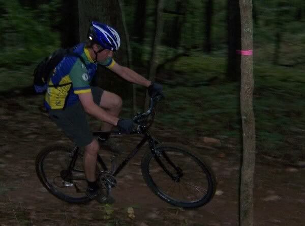
Wode! Watch out for the tree!
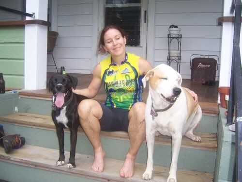
I changed rear cogs the other day to a 22 and found that I was moving along quite well, too. We were mostly on nice buff singletrack for the whole day so nothing really stands out except gasping for breath, hammering out of the saddle, and not beleiving Wode was right on my tail. Once we were finished we ran into India in the parking lot. We talked with her for a minute, it was nice to see you ready to ride India! Wode and I were back at the cars quickly after that. Fun and fast after work ride.
Thursday, September 21, 2006
Hike-Bike-Hike-Bike-Hike with Mike R.
Mike Rischitelli and I got out yesterday for one of the best rides I’ve had in recent memory. I’ve been riding a bunch lately so that says a lot about how good of a time I had.
We decided right from the beginning to have a cross-training day and to include two hiking trails in our route. Please everybody DO NOT RIDE hiking trails. We walked up them. It was a decision we made knowing full well that we needed to stay off our bikes…. and we did.
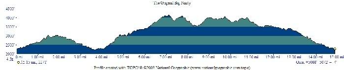
The route was as follows: Coontree->Bennett->Pressley Gap->Black Mountain->Buckwheat->Bennett->Coontree. We hiked up and down Coontree and up Pressley. a.k.a. the Original Big Nasty…Just over 15 miles, Just over 5000 feet of climbing.
Right from the start we pushed the pace. It was a very quick hike/run using the bikes as a crutch. We pushed hard, we hiked fast, we made it to Bennett in no time at all. Down Bennett to 477 was all business. We flew through the turns and off the step downs. Again, the trail was complete more quickly than I had expected. Off the bikes again for the express route to Pressly Gap. I took the longest strides I could and kept up a super fast hiking pace. Over the log bridges, up the steps, wham-bam-thank-you-ma’am holy crap we’re at the top already.
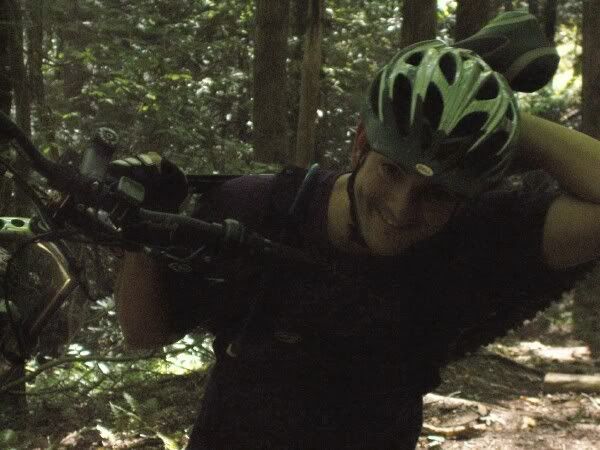
Here’s Mike showing how to ‘Hike-a-Bike’
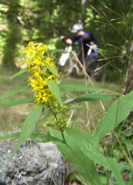
Next was Black mountain trail up past Turkey Pen. That trail is sick steep. I turned that big single speed gear over and over. I would get off the bike and continue hiking as fast as I could as a ‘rest’ and would hop on and turn the gear and would take off like a rocket. Up Up Up Up Up we went and I got to Turkey Pen, more or less the top of Black Mountain, and felt like a man possessed. My eyes were wide, my heart was pounding, my ears were whistling and I while I waited for Mike to arrive I took in the beauty of the last days of summer. Crystal clear skies, low humidity, in the low 60’s, and flowers everywhere.
Here’s Mike hiking again! Oh, and a pretty flower, too. Black Mountain trail at Turkey Pen.
We then pressed on with no other break. Down through the saddle between Black and Clawhammer was next and we both cleaned the super-tech near-vertical switchbacks. Over Clawhammer, quick pause at the overlook and next was the serious switchbacks heading to the shelter. By the time we made it to the bottom my arms were feeling pretty worked so I had to chicken out and walk a few of the really tough switchbacks. Zero rest at the road, we just hammered up the trail towards Club Gap. Again, I would get on and take off like a bat out of hell. I would get off and hike like I was in a race of some sort. Mike was never more than a moment behind. We both FLEW off the notch log and hit the next upward face at full speed. I had to walk a bit of the steepest section but decided that since I’ve climbed it in middle ring before, I could SS up it, too. I was right! I got back on the bike and mashed the gears again and again until I was at the top and had this look on my face:
At the top we had a quick snack then immediately started to hammer the rough stuff to Club. I led that descent and had sooooo much fun. I came rocketing into the gap with fire in my eyes. Mike arrived and without any hesitation we started up Buckwheat. I felt the first pangs of fatigue then. I had to walk a section that wasn’t nearly as steep as the hill before Club but my spirits were still very high. After the top of Buckwheat Knob the REAL descending starts. There’s a section known as ‘devil’s staircase’ that is seriously technical and steep. Roots, Rocks, Switchbacks, dangerously fast straight aways, waterbars, erosion gullies, and did I mention elevation loss? Smash! Bang ! Boom! We were already at 477! Holy Crap. That’s when I realized we were headed for my personal best time for this route.
Next was the climb to the field on Bennett and the big bad descent of the day. Buckwheat is fast and tech, Bennett is… well… there is great potential for grave bodily harm on Bennett. Mike cleaned the squeezebox and hauled towards the Clint huck. I smashed my way behind hima and was destracted by a big hole into oblivion that I had never noticed before. I came to my sences as Mike was saying about his line ‘Too Wide Too Wide’ and I turned sharp to the right then sharp to the left and threaded the needle between the launch rock and the slab. Clean as a whistle! We then faced yet another hike-a-bike and rip-roarin’ descent. I nearly lost control a couple of times, I knew fatigue was setting in. We closed the loop at Coontree and fast hiked back down. That was not an easy choice, to get off the bikes there, but it HAD to be done. We didn’t slouch on the hike/run down the mountain and madde it to the road red faced and once again out of breath. Now for the most amazing part… 3.5 hours total. We hauled asssssssssssssss.
Wednesday, September 20, 2006
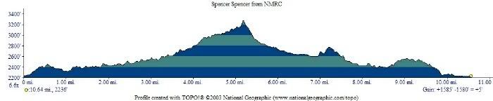
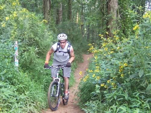
NMRC->5000->Spencer->Spencer->ReservoirRd.->Lower Trace->NMRC w/ Mike R.
Mike Rischitelli and I had a fun sub- 2 hour ride yesterday. I went to his house to change the rotors and pads on my Jeep and brought my bike along just in case we had time to hit the trails after the maintenance. Well after a few hang-ups we found ourselves at North Mills River campground right at 6pm. We started the ride fifteen minutes later by heading up 5000 to Spencer Gap trail. Did we try to slowly warm up? Hell no, we don’t need no stinkin’ warm up! We started mashing right from the get-go. Up to the singletrack where the gate had been left open. Weird. If you open gates people, close them behind you! Anyway, up up up to Trace Ridge we went. I had to get off in the steep field but otherwise had a great climb.
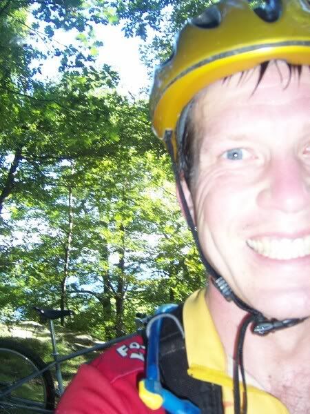
Here I am at the Spencer/Spencer/Trace intersection:
At Trace we decided to head down Spencer Branch. It had been a long time since I went that way and it was a ton of fun. The top is seriously steep but wide enough to have multiple lines running through it. There are rocks in every configuration of shape and size known to man which provide ample opportunities for launches, tight squeezes, pinch flats, and carnage. I’ve actually broken a frame on that descent… Well, nothing bad happened this time. We had a blast hauling down about a quickly as hardtails (fully rigid for me) could through the nastiness. The trail then mellows and starts to run with a creek. It still is downhill, for sure, but much easier. It was starting to get dark by the time we hit the intersection with the never-ending-road but we decided to continue on Spencer. Down in there the trails are plain ‘ole classic Pisgah singletrack, the reason I moved here. There are roots, rocks, mud pits, creek crossings, sudden short uphills, jumps, hips, a beaver dam, pretty flowers, and places that will send you flying over the bars if you’re not careful.
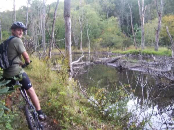
Here’s Mike at the beaver dam:
Up and over the short but annoying climb and down the bobcat downhill and Spencer finally dumps out on the Reservoir road. We upped the pace there and made our way to the Trace Ridge parking lot very quickly. The next decision was to either take gravel back to the car or lower Trace to the fisherman’s trail (shhhh! don’t tell the fishermen we were there) so, yes, we took lower Trace. Luckily Mike had the forethought to bring lights on a ride in Pisgah that started after 6pm in the middle of September…. I sure didn’t… because we needed them. I followed his wheel (and light) through the slickrock section, down the step-downs, over the pipe, and all the way to the river. I nearly lost it right at the end. My front wheel found nothing to stick to, I guess. It was just floating around out there with no care for my well being at all….. I yelled out, the tire hooked up, I got a niiiiiice rear tire burn on my leg, and I saved it. We crossed the river and were at the vehicles in a matter of minutes later. Fun, fast ride. 1:45 total time in the woods.
Tuesday, September 12, 2006
Two Hours at Bent Creek with Ian
Ian and I just got in from a great two hour ride at Bent Creek.
New Parking Lot-> Ledford Gap Rd.->Sidehill Rd.->Ingles Field Gap->N. Boundary->Green Slick->Sidehill->Little Hickory Top->Ingles Field Gap->???->???->??? Ian led the rest of the way over to the pavement.
Two photos for now…
Ian and some pretty flowers at 5 points
and Ian saying ‘hello’ at the top of Green Slick.
Friday, September 8, 2006
New fork Shake-Down ride
Got a quick 75-90 minute ride in yesterday at Bent Creek. Bent Creek is so freakin fast now that all the trail work has been done. I’m not going to say I love it because I miss the old Bent Creek. All the technical stuff is long gone but you know, you can’t cry about it. It’s just like getting a bad haircut. It’s all awkward and you miss the way it was… but it’ll grow back soon enough.
Started at the new parking area->Ledford Gap Road (?)->Sidehill Road->???->Ingles Field->Tony Michaels->Green’s Lick->Sidehill->Little Hickory Top->Ingles Field->???->Sidehill Road->Ledford Gap Rd.
Started at 4 P.M. with threats of rain. Two guys got out of a car that said ‘Drill Sargent’ on the back and ran up Ledford Gap Rd. doing the hup-two-three-four march chant thing. An odd sound in these woods for sure. Once on the bike I immediately noticed the two pound difference between the rigid and the suspension forks. Combined with the singlespeed I was in for a quick climb. Up to the singletrack and up to 5 points. I had to walk a little bit there but not for long. Rode right through 5 points and continued up to Green’s Lick. I felt great there and stood up on the single gear almost the entire way up. I was surprised by how quickly I made it to the top. I think I even said out loud ‘No Way!’ because I had ridden by the spring that signifies the top for me without even noticing. Next I started down Green’s Lick and decided to give the new fork a good test. I cranked down the hill, made it past the tricky outside turn, and then really started to rail. I hit a jump bigger than ever before for me on that trail, swooped through the berms, really started to get comfortable and it started to rain cats and dogs. Green’s Lick should be called Red and Slick because once the ground got a little wet all that newly exposed clay got really nasty. Hardpacked, yes, but slick as phil wood grease. I made my way to the bottom and the rain had let up a bit so I turned onto Sidehill. Climbed that pretty fast but had to get off once or twice. I was wondering if I was going to eventually snap my pedals off with the SS thing. Anyway, I continued up Little Hickory top and the rain had pretty much stopped. To 5 points again and back to the car the way I came in. I didn’t get to test the fork on the second downhill because the trail was filled with water. Respect the trail, don’t rail it in the rain. It was a great first ride on the new fork. Here’s what I had to say about it on mtbr.com:
Hey everybody! Thanks for the kind words. I got a quick 90 minute ride in yesterday afternoon and man o man this thing rides sweet. The tubes are a bit thicker than the last fork and I can feel a bit less movement during climbing singletrack and descending gravel roads. It’s crazy how much it still ‘absorbs shock’ though. Tons of Fore-Aft movement (which, as I said, is good) even though it’d thicker and has the TA. This fork really shines (pun intended) during singletrack descending. Actually, I’ll go so far as to say: If you’re riding rigid in the mountains and are not a racer looking for ligtning fast tube changes… Your fork is obsolete. Drop everything and order one of these from Walt. While descending the front wheel tracks better than ever before. When landing jumps the wheel doesn’t want to wobble all around, it just makes contact with a soft feeling ‘THUD’ rather than the sharp ‘SMACK!’ then trail wiggle that I’m used to. I had thoughts of the feeling of being a kid on a bmx bike on a bmx track. I had memories of the hopey damper… The fork legs are working as one. I even thought to myself ‘I’ve found the replacement for sliced bread!’
So, there ya go. First impression of the fork? Two thumbs up.
Tuesday, September 5, 2006
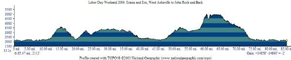
Tour de Pisgah ~ Labor Day Weekend 2006
Day 1
West Asheville->191->Bent Creek Rd.->479->BRP->Trace Ridge->Fishermans Trail->1206->276->475B->475->??? to camp. 40 mi.
Day2
???->475->276->477->Clawhammer->Buckhorn Gap Trail->S. Mills River Trail->S. Mills River (Gauging Station) Rd.->1206->Pilot Rock trail->BRP->479->Bent Creek Rd.->191 back to West Asheville 45 mi.
Profile.
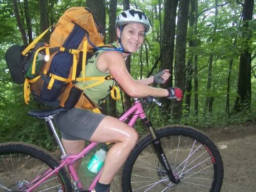
Erinna on 479.
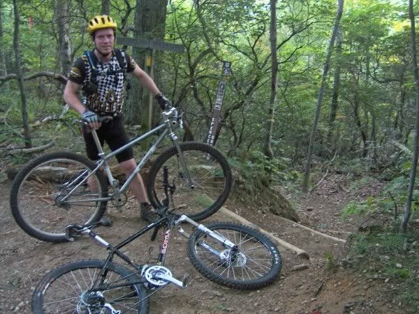
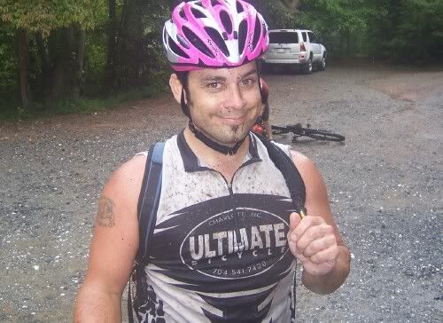
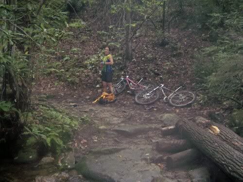
Bill in the Trace Ridge Parking Lot.
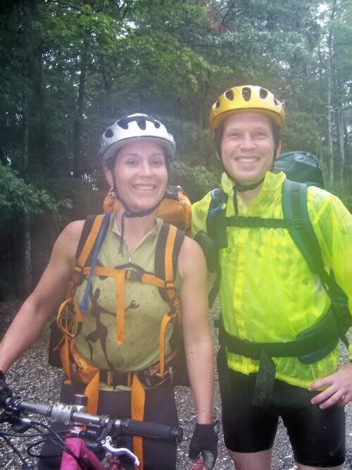
and hand the camera to Bill… here’s a shot of Erinna and I
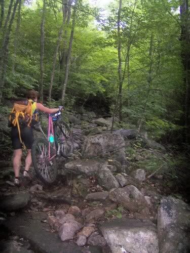
Jessie hitting the gap at the bottom of Trace.
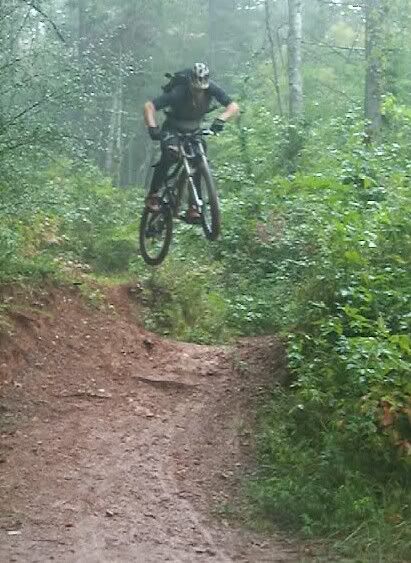
Yeah!
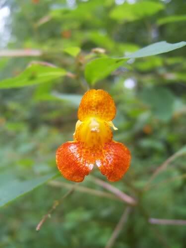
Pretty Flower:
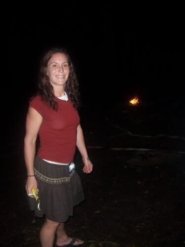
Here’s Erinna at camp
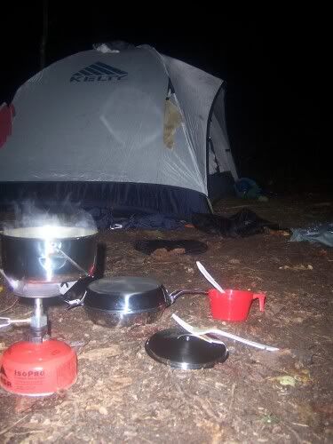
and camp at camp
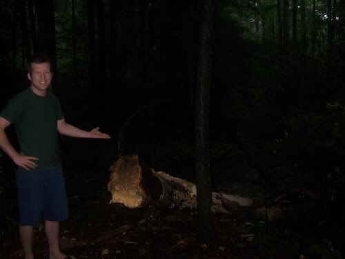
a tree nearly fell on us:
bottom of pilot
more Pilot Rock
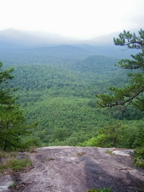
The view from the top of Pilot Rock:
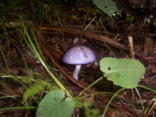
big ole shroom
and back at home after day 2